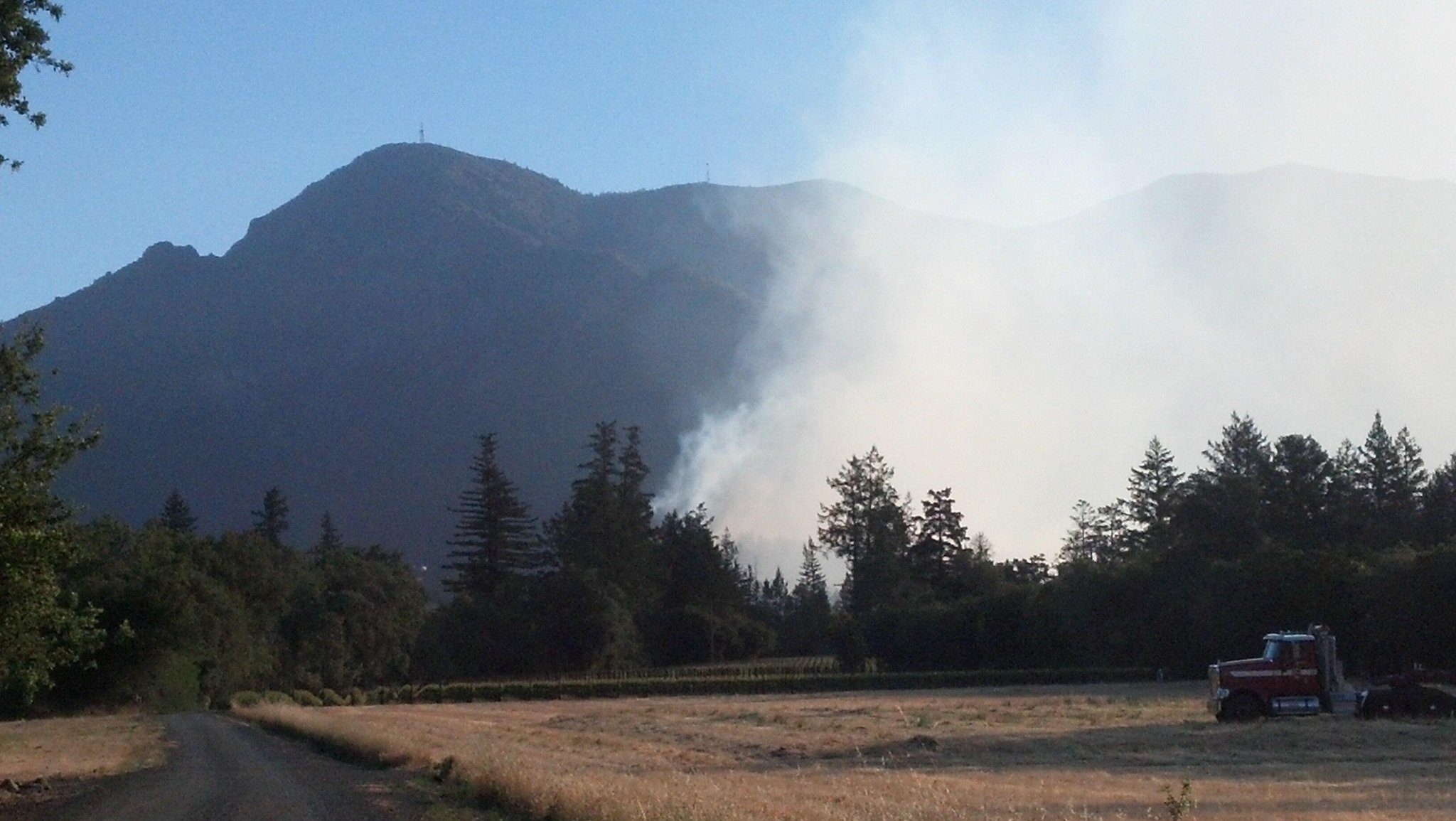
Thursday, May 2, 2013

CA-TUU-Deer 200 acres, Forward Spread Stopped.

Update 1330 hrs: Approx 200 ac, Shaky Containment, Forward Spread Stopped.

Location: 29277 Reservation Road, Porterville, CA 93257, possible second fire at Success Valley drive and Reservation Road
Reported Date/time: 1320
IA: CAL FIRE TUU
ROS: Moderate
ROC: Possibly two fires
Resources:
Cal-Fire BC4113
4163
4153
4159
4184
4164
4151
DZR 4143
DZR 4141
TLC Units: BC-2
WT-19
PT-21
PT-22
SQF Units: BC-23
C-9
WT-2
E-21
TIA(Reservation BIA) Units:
PT-91
E-92
E-91
Cooperating Agencies:
Weather Info: Porterville, 84 degree's, 16% humidity Winds WNW 10mph
Special Conditions:
Other Comments:
Radio Frequencies: Local - 151.190Tac. - ???
A/G - 151.220
Air - 151.3025
Air/Air - 123.975

CA-TGU-306 #Wildfire 217 acres, 75% contained #CaFire

Update 1930hrs 5-2: 217 acres, 75% contained. Major problems remains the threat to annual grazing lands for cattle industry. Expected containment 05/03.
Update 0930hrs 5-2: 110 acres, 5% contained.
Update 2030hrs 5-1: B2514 reports 50-60 acres, multiple spots, no structure threat, high growth potential.
Update 2000hrs 5-1: 40-50 acres moderate rate of spread with a 1/4 acre spot. Resource request: 3 type 3 engines, 1 dozer, 4 crews
The old ATT Long Lines tower is in immediate threat.

Wildfire Elk Creek area, Glenn County
Location: Elk Creek area, Glenn County

Reported Date/time:
IA: 
ROS: Moderate
ROC: B2514 reports 25 acres SROS no access. No Current Structure threat

Resources: Bravo 58, Elk Ch50, B2514, MNF B31, E2574, E2571, E2551, MNF E36, MNF E336, D2542, D2544, VAL 1, VAL 3, VAL 5, VAL 6, ISH4, SCK 2, SCK 5, MNF TAC WT


Cooperating Agencies: 
Weather Info:

Special Conditions:

Other Comments:
Radio Frequencies:

Maps:

Agency Website:
Online Scanner:

Live Video:
Web Cams:

CA-RRU-Van Buren #Wildfire #WUI 12 acres. 100% Contained #CaFire

Update 1230hrs: Van Buren x Jurupa Rd Jurupa Valley. 12 acres. 100% Contained.
Update 0930hrs: The fire is still 5 acres, 50% contained. Two residential structures were destroyed, two were damaged, five outbuildings were destroyed, 10 vehicles destroyed and one boat destroyed. Jurupa Rd is closed from Van Buren to Rutile and Van Buren is closed from Jurupa to Rutile
Update 1030hrs: 2 Structures Lost, Mira Loma School and gas station evacuated


Location: Riverside County, Van Buren Blvd. & Jurupa Rd.
Reported Date/time: 5-2-13 8:24 AM
IA: 2nd Alarm
ROS: Structure Threat.
ROC: rapid ROS, high winds

CA-VNC-#SpringFire Wildland Fire 28,000 acres - 56% contained Containment expected May 6th.. [NEW Perimeter and Hot Spot Map]

CA-VNC-Spring - VENTURA COUNTY - WILDFIRE now renamed CA-VNC-Springs

NEW PAGE UPDATES NOW POSTED HERE http://calfire.blogspot.com/2013/05/ca-vnc-springs-28000-30-contained.html

Update 1840 5-3: 28,000 acres - 56% contained Containment expected May 6th.. 
Pacific Coast Highway has NOT been re-opened due to concern about possible rockslides. It is closed between Las Posas and Yerba Buena.
 The focus of firefighting activities overnight will be in the Yerba Buena Rd. area where a concentrated attack will be focused.
Update 1646 5-3: Pacific Coast Highway will reopen to traffic in both directions at 5:00 p.m. Many cross streets, however, will remain closed. Motorists are advised to drive carefully and watch out for emergency vehicles that may still be in the area. 
Update 1616 5-3: The Springs Fire is threatening Newbury Park 18,000 acres and 20% containment.
Update 1545 5-3: 18,000 acres - 20% contained ROAD CLOSURE: The hard closure of Potrero Rd. now extends from Reino Rd. to Trentwood Dr.
Update 1414 5-3: More Evacuations: Fire well established in branch 2 making run towards Hidden Valley.
Update 1304 5-3: IMMEDIATE EVACUATIONS
South side of Potrero Rd. from Reino Rd. east to 930 W. Potrero Rd., including Hidden Valley Rd. south. 4,000 residences, 300 commercial properties and 50 outbuildings are threatened.
Update 1120 5-3: Acres: 10,000 and growing.Containment: 10%
Homes Threatened: 4,000. 15 damaged, none destroyed.
No firefighter or civilian injuries.Personnel: 954 with more in route. Div. Q (PCH side) starting to get onshore wind, slopover with good downhill runs. The air attack on the Springs Fire now consists of 8 water-dropping helicopters and 6 fixed-wing air tankers dropping fire retardant
OES ST 2802A OES 8635 (OES Strike Team 6848C) and OES 255 (Strike Team OES 6800A) 6440C, XED-4075C, SNF KINGS RIVER IHC assigned. #CaFire #SpringsFire

Fire Hot Spot and Perimeter Map
Springs Fire Header
Photo by Christopher Loza
Update 0830 5-3: [Springs, Fire VNC 25314] 10,000 Acres, 10% Contained
Threat to Laguna Peak Communications, Point Mugu NAS, Santa Monica Preserve, Cal State Channel Islands, NPS
Evacuations are still in progress.
XMY2175C, XSD 6441C from San Diego, XCA 4050 C, OES 5801-A enroute with STEN and STEN(t) enroute..
OES 289 (Santa Clara County Fire Department) en route (02:30)
CNT 2310C (Santa Clara County Fire Department) en route (03:00)
OES ST 2803A enroute/assigned 0500 (Santa Rosa, Sonoma, Vacaville, Napa, Lake County, Stl-SR)
OES ST 2802A from Marin County departed this morning: Marin County Fire, Kentfield, Ross Valley, San Rafael, ST Leader from Mill Valley & 5th Engine from another county.
Update 0800 5-3: 10,000 acres, 10% contained.Update 1800: 8,000 acres, 10% contained.
2,000 homes have been threatened, 15 sustained damage, none were destroyed.
925 personnel are now committed to the fire.
Road Closures: PCH between Las Posas and Yerba Buena, Yerba Buena Rd., Deer Creek Rd.
Mandatory evacuations: Sycamore Canyon, La Jolla Canyon and Brrome Ranch.
Dos Vientos: residents with ID are being allowed in.Update 1720: A full update is expected sometime tonight. Current numbers for the fire that started this morning near Camarillo Springs:
6,500+ Acres
0% Containment
850+ Firefighters and Law Enforcement Personnel
96 Fire Engines
6 Copters
Dozens of Hand Crews
3 Fixed-Wing Aircraft
Fire departments from across Southern California, the Ventura County Sheriff's Office, the CHP, ambulance companies, the American Red Cross and many other agencies are assisting us and the residents of Ventura County.There is a smoke advisory for the smoke coming from the burning agricultural buildings near Cal State Channel Islands. That area is currently under evacuation orders. Anyone still in the area should evacuate and make all efforts to avoid the smoke. 

OSCC 1500 Springs Fire VNC 25314, Hwy 101 @ Conejo Grade, Ventura County.  6,500 acres, 10% contained.  Evacuation of Cal State Channel Islands lifted.  Rapid rates of spread during the day.  Current threat to power transmission lines per Edison either 220kv lines, steep inaccessible terrain, limited aircraft due to wind and miles of open line.  Cal Fire IMT 5 Smith to assume command tomorrow @ 0600. 2 USFS S/T engines committed.
Update 1420: There are now nearly 600 fire and law enforcement personnel assigned to the Spring Fire that started near Camarillo Springs this morning. There are 96 fire engines, six helicopters, five dozers and dozens of hand crews on the fire. Firefighters have responded from the VCFD in addition to firefighters from Oxnard, Ventura, Santa Paula, Naval Base Ventura County, Cal Fire, Orange County, Los Angeles County and the City of Los Angeles. Law enforcement partners include the Ventura County Sheriff's Office and the CHP. Major fire has passed Dos Banos? area. Ventura County Hazmat 72 responding to pesticides/unkn chem plume some sheltering in place and evacuations, road closures due to plume #CaFire

Evacuations in Dos Vientos Area of Thousand Oaks, Camarillo Springs Area And UC Campus Evac Centers: Calvary Community Chapel in Camarillo and Thousand Oaks Community Park.


Update 1320: Pacific Coast Highway NOW closed between Las Posas Rd. and Ventura/LA County Line.
Official Ventura County Fire Map:
CA-VNC-Spring WildFire Evacuation Perimeter and Fire Perimeter Map
CALIFORNIA: DRAMA IN VENTURE CO.! OFFICIALS CONCERNED CHEMICA... on Twitpic Update 1320: 6500+ acres, no containment OFFICIALS CONCERNED AGRICULTURAL CHEMICALS COULD IGNITE AND EXPLODE. #SPRINGSFIRE 
Update 1220: 6500+ acres, no containment, AA to Ventura, "we have shut down the airshow, helicopters only due to winds.Ventura to IC, we have ordered 4 AT and 4 helicopters... We have no air tankers. 
More than 500 firefighters are now either on the ground or in route to battle the fire that began this morning near Camarillo Springs. The fire is over 2,000 acres and continues to spread. Residents are encouraged to comply promptly with evacuation orders. All residents in the general area should be aware of the risk from windborne embers. Monitor your property and extinguish any embers you can safely handle. 
Update 1120: PCH is currently being shut down. Very Windy, fire moving towards Newbury Park. Recreation vehicle storage yard parking area destroyed. More than 500 firefighters are now either on the ground or in route
Screenshot from KCAL Helicopter video
Update 1020: Sustained winds 20+ mph, gust 30-40 mph. RV Park vehicles and outbuildings in flames, Channel Islands UC Campus evacuated due to air quality. 4 AT's and 4 Helicopters working the fire.
Update 1020: 2000 acres Tanker 73, 76, 78, and  are working the fire.
Update 0945: Spotting fires 1/2 mile, Report of a spot fire on the North side of the 101, fire is approaching Via Santana Road.
Update 0845: Fire is approaching a residential area IC requesting 4 type 1 ST Immediate need for structure protection.
Update 0745: 50 acres now


Location: Ventura County near the 101 Freeway in Camarillo
Reported Date/time: 6:45 a.m near the Camarillo Springs Road exit

IA: Brush fire burning in steep terrain.
Second Alarm 5 copters, 6 fixed wing, 6 Crew ST requested
ROS: Rapid
ROC: 25+ acres, ROS
Resources:
LAC ST1107A (Engs 94, 106, 116, 158, 236, & BC7)
LAC ST1105A (Engs 65, 88, 89, 99, 67 & BC5)
Fire Fighters: 
Engine Companies: Fire Crew(s): 
Bulldozers:
Water Tenders: 
Helicopters: 
Air Attack: 
Air Tankers:
Truck Companies: 0 
Overhead Personnel: 
Medics(s): 0
Ambulance Air: 0 Ground: 
Specialized Equipment: 
OES: 
Cooperating Agencies: 

Weather Info: Windy, Low RH
Special Conditions: 200 kv transmission lines in area.
Other Comments:
Radio Frequencies:
Maps:
Agency Website:
Online Scanner: 
http://www.broadcastify.com/listen/feed/2858
Live Video:
Web Cams:

Wednesday, May 1, 2013

CA-RRU- #SummitFire 3,166 acres - 100% Fire Is Fully Contained #CaFire

Summit Fire RRU-44298
Update 1800hrs 5-4-13:- 3,166 acres, 100% contained 
Update 0700hrs 5-4-13: 3,166 acres - 85% Contained, Resources remain at the scene as they continue improving containment lines and patrolling the fire area for hot spots. Residents and motorists are urged to exercise caution when driving through the fire area and yield to emergency vehicles. Updates will continue to be posted as information is made available.
Update 1400hrs 5-3-13: 2,956 acres - 65% contained 
Update 0800hrs 5-3-13: 2,956 acres, 55% contained.  Evacuation Orders lifted for all areas of the fire.  Projected minimal spread and continuing to clean up line construction.
Update 0900hrs 5-2-13: 3,000 acres 40% contained.
 
ALL EVACUATIONS HAVE BEEN LIFTED

RIVERSIDE COUNTY SUMMIT FIRE HOTSPOT AND PERIMETER MAP 
Update 2100hrs:  #SummitFire The fire is now approximately 2,956 acres. 35% contained.
Update 2000hrs: Evacuation orders for residents in the Highland Springs Mobile Home Park have been lifted. 
ROAD CLOSURE: Motorists should drive with caution due to fire equipment working in the area and also obey road closure signs and barricades.
Mias Canyon Road has been re-opened. 
Bluff Road remains closed. 
Evacuation Comments: 
  • The Highland Springs Mobile Home Park has been evacuated, inclusive of approximately 200 mobile homes.
  • Residents along Indian School Lane and the top of 8th Street have been evacuated by Banning PD. 
An evacuation center has been opened at the Banning Community Services Center Located at 789 North San Gorgonio Avenue in Banning.
Evacuation center for small animals located at San Jacinto Valley Animal Services 581 South Grand Avenue in San Jacinto. 
A large animal evacuation center has been opened at Noble Creek Park - 390 Oak Valley Parkway in Beaumont.
ROAD CLOSURE: Highland Springs Avenue, north of 8th Street, has been closed at the request of Cal Fire. Please take an alternate route and avoid this area.


CA-RRU- Summit Wildland WUI fire Hot Spot & Perimeter Map
CFN - 5-1-2013
CA-RRU- Summit Wildland WUI fire Perimeter Location Topo Map
CFN - 5-1-2013
Update 1800hrs: 1750 acres and 0% The Summit fire is headed towards the City of Beaumont. There is the potential for evacuations of the Sundance Community. If this happens, Law Enforcement will notify those neighborhoods affected and residents will have approximately 15 minutes in which to evacuate the area. If evacuations do occur, the Civic Center on 6th Street will become an evacuation center. 
CA-RRU-Summit Wildland WUI fire Perimeter Location Map
CFN - 5-1-2013
Home Destroyed In Summit Fire 
Update 1700hrs: 1750 acres and 0%
Update 1600hrs: At least one home destroyed, 1,500 acres,  0% contained. One firefighter received minor injuries.
Update 1530: Fire is now 200 acres and 0% contained.
Update 1400hrs: Acres 150+, IC asked for 25 more any type engines. Evacuations Indian School Lane and 8th Street 
Reports of RH 12% Fires moving into heavier brush' rapid ROS
Update 1320hrs: Fire is now approximately 60 acres. Residents on Indian School lane and the top of 8th Street have been evacuated by Banning PD. Road closures in place all of Wilson Street between San Gorgonio and Highland Springs Avenue. IC requesting a total of 6 AT's and 6 Helicopters as well as 12 closest any type engines. Helo's are for 4 T2's and 2 T1's. Also requesting 4 DivS, PIO and safety officer

Location:  N. San Gorgonio Avenue Near Summit Drive, Mias Canyon X Bluff Road.

Banning is located in Riverside County about 33 miles east of the city of Riverside.
Reported Date: Wednesday, May 01, 2013 12:38 PM
IA: CAL FIRE/Riverside County Firefighters are on scene of a wildland fire near North San Gorgonio Road and Summit Drive in the Banning area. The fire is approximately 10 acres, burning in light to medium fuels at a rapid rate. Outside temperature 80 degrees, humidity 12%, winds from the east at 29 mph. Updates will be posted as information becomes available.
ROS: Moderate
ROC: 10 acres in light to medium fuels. Winds out of the east gusting to 29.
Resources:

Fire Fighters: 425
Engine Companies: 46
Fire Crew(s): 16 
Bulldozers: 2 
Water Tenders: 1 
Helicopters: 6 
Air Attack: Yes
Air Tankers: 6
Truck Companies: 0 

Overhead Personnel: 16 
Medics(s): 0
Ambulance Air: 0 Ground: 1 
Specialized Equipment: Helitender
OES: Yes
Cooperating Agencies: American Medical Response, American Red Cross, City of Banning, Banning Electric, Banning PD, CAL FIRE/Riverside, CAL FIRE/San Bernardino, Cathedral City FD, City of Corona FD, Morongo Fire Department, Murrieta Fire Protection District, Orange County Fire Authority, Palm Springs FD, Pechanga FD, Riverside City FD, Riverside County Fire Department, Riverside County Fire Office Of Emergency Services, San Bernardino County Fire Department, USFS – San Bernardino,
Fuels:
 Moderate Brush moving into heavier fuels
Weather Info: 80 degrees, RH 12, East Wind 29 mph
Special Conditions:

Other Comments:
Radio Frequencies:
Maps:
Agency Website: http://www.rvcfire.org/_Layouts/Incident%20Information/IncidentInfoDetail.aspx?111
Online Scanner:
Live Video: http://ktla.com/live/#axzz2S4v0sAUQ
Web Cams:

CA-BTU-Panther #Wildfire 6,964 acres 95% containment Containment expected tomorrow.

    Butte County Fires:
    Cal Fire is working on limited resources from county and state because they are not fully staffed for fire season levels yet. Cal Fire stated there is no threat of the fires merging at this time due to the distance between the fires.

    The fires are approximately 2 miles apart, and their cause is under investigation.
    Update 1630 5-7: 6,964 acres 95% containment  Containment expected tomorrow.
    Update 1630 5-7: 6,864, 80% contained.
    Update 0800 5-7: 6,864, 80% contained.
    Update 0800 5-6: 6,864, 80% contained. Isolated pockets of downed heavy fuels continue to hamper mop-up operations. Update 0800 5-6: 6864 acres, 60% contained, Containment expected May 9th. 40 Water Tenders working this fire
    Fire remains in the Mill Creek and Deer Creek drainages. There is no longer an imminent structure or infrastructure threat. The predicted and resulting thunderstorm activity during yesterday and last night had minimal impact on the fire due to the continued efforts of firefighters. Use of fire crews is still, and will be critical due to the rugged terrain. 
    Fire continues to burn in the Ishi Wilderness Area with slow growth due to MIST (Minimum Impact Suppression Tactics) tactics employed by US Forest Service Hotshot crews. The US Forest Service Hotshot crew’s aggressive work yesterday enabled the MIST tactics to be ahead of schedule.
     With favorable weather forecasted today, high humidity’s and low temperatures, the predicted containment date will be met.

    Road Closures: The area between Highway 32 and Highway 36 known as the Deer Creek and Mill Creek Recreation Area as well as the Ishi Wilderness are closed to the public. Highway 32 and Highway 36 will remain open but be aware of the heavy fire equipment traffic on those highways.


    Update 0800 5-5: 6,792 acres 40% contained. Fire continues to have short range spotting due to predicted instability and isolated thunderstorms. 
    Cedar Fire within the Panther incident is 72 acres and 100% contained.
    Update 0800 5-4: 6,648 acres, 30% contained. Threat remains to the private timber lands, Deer Creek and Mill Creek drainages. Additional threats are to archeological sites in the Ishi wilderness and McCarthy historic lookout.
    Update 0800 5-3: Total Fire Personnel: 1094 Firefighters
    Engines: 81 engines
    Fire crews: 32 Fire Crews
    Helicopters: 7 Helicopters
    Dozers: 14 Dozers
    Water tenders: 6 Water Tenders
    Conditions: Conditions are windy and dry. Burning in timber and timber slash. Moderate to rapid rate of spread in steep terrain. Fire is in the Mill Creek and Deer Creek drainages. There is no imminent structure or infrastructure threat. Fire is being driven by gusty down-canyon winds. Use of fire crews is critical due to rugged terrain.
    Fire activities will not impact planned activities at the fairgrounds this weekend.
    Update 0800 5-3: 6,393 acres, 10% contained. Decreased acreage due to updated mapping. Major spotting issues due to severely dry fuels. Major problems are remote access and steep terrain.

    Wildland Fire Perimeter and Hot Spot Map
    Update 1600 5-2: 10,000 acres, 10% contained. Threat to prime SPI and Collins Pine timber lands.  Current threats are to Deer Creek and Mill Creek drainages, threatened species, including spring run Chinook salmon and wilderness habitat.  Additionally, there are threats to archeological sites in the Ishi wilderness. 
    Update 2000 5-1: Currently burning at 300 acres with 0% containment at the 140K3 line South of Butte Meadows. Personnel include six hand crews, six dozers, six engines, three water tenders, and 15 overhead personnel. Total personnel is 141. No road closures, evacuations or structures threatened. two helicopters were providing support earlier this afternoon, but turbulent winds have caused unsafe conditions to execute air support.
    Update Noon: Panther Fire is 120-140 acres with 0% containment IC has ordered 6 dozers. - Cal Fire has published a release stating the Panther Fire is burning a total of 100-120 acres, and the Cedar Fire 30 plus acres.
    Conditions remain very windy and dry, with burning timber and timber slash. The Panther Fire is anticipated to grow to several hundred acres. 

    Update 1130hrs: CalFire calling this the Panther Fire and give a 100 acre sizeup now.
    Update 1045: Approximately 60 acres.
    The fire was reported at 9:12 a.m. this morning near the 140 K line also south of Butte meadows at 20-30 acres. The fire is inside a clear cut but spotting outside that area. Current staffing is three overheads, eight engines, and one tender.

    Date/Time Started: May 1, 2013 9:12 am
    Administrative Unit: CAL FIRE Butte Unit
    County: Tehama County
    Location: Northwest of Butte Meadows K-Line off of Hwy. 32, 140K3 Line, 8 miles northwest of Butte Meadows 
    IA:  9:12hrs; 20-30 acres. The fire is inside a clear cut but spotting outside that area. 
    ROC: Fire is burning in clear cut slash, spotting from clear cut to clear cut.
    Resources: 116 personnel, 16 engines, one air tanker, one helicopter, 40 water tenders and six overhead personnel
    Fuels:  Timber and timber slash.Radio Frequencies: 
    Maps: 
    Weather Info: Very windy and dry
    Agency Website:
    Online Scanner:
    Live Video: 
    Web Cams:

    News: KHSLTV - http://www.khsltv.com/content/localnews/story/Cedar-Panther-Fires-Have-Increased-to-a-Combined/ii-4Mx84oESi6U-LQUI1Zg.cspx
 -  

CA-BTU-CEDAR Wildland Fire 55+ acres, 40% #CaFire

BUTTE COUNTY - CEDAR WILDFIRE

    Butte County Fires:
    Cal Fire is working on limited resources from county and state because they are not fully staffed for fire season levels yet. Cal Fire stated there is no threat of the fires merging at this time due to the distance between the fires. 

    The fires are approximately 2 miles apart, and their cause is under investigation.


    Update 1600hrs:
    CEDAR - Fire is currently burning at 55 acres with 40% containment at the 10E line South of Butte Meadows. Personnel include eight hand crews, three dozers, 15 dozers, 1 air tanker, one helicopter, four water tenders, and six overhead personnel. Total personnel is 187. No road closures, evacuations or structures threatened. 

    PANTHER - Currently burning at 300 acres with 0% containment at the 140K3 line South of Butte Meadows. Personnel include six hand crews, six dozers, six engines, three water tenders, and 15 overhead personnel. Total personnel is 141. No road closures, evacuations or structures threatened. two helicopters were providing support earlier this afternoon, but turbulent winds have caused unsafe conditions to execute air support.
Update 11:00hrs: 30 acres

IA: 4:16 a.m 
Location: Near the 10 E line South of Butte Meadows. 
ROC:  20 plus acres logging slash. Strong NE winds, fire is currently spotting and being fueled by North winds.
Structure threat: Not currently
Resources:  Current staffing is 3 overheads, eight engines, four tenders, two dozers, 4 crews, one helicopter, one tanker.
Cal Fire is working on limited resources from county and state because they are not fully staffed for fire season levels yet. Cal Fire stated there is no threat of the fires merging at this time due to the distance between the fires. 
Radio Frequencies:
Maps:
Weather Info:
Agency Website:
Online Scanner:  http://www.broadcastify.com/listen/feed/11764/web
Live Video:
Web Cams:


CFN - California Fire News 2013 

 -  

CA-LNU-Silverado Wildland Fire 75 acres - 60% contained


    Multiple fires burning in Napa & Sonoma Counties.
     

    RED FLAG WARNING remains in effect for High Fire Danger.

    Name: Silverado Fire
    County: Napa County
    Location: 7300 block of Silverado Trail, north of Napa
    Administrative Unit: CAL FIRE Sonoma-Lake-Napa Unit
    Status/Notes: 75 acres - 60% contained
    Date Started: April 30, 2013 11:44 pm
    Last update: May 1, 2013 7:00 am

    CFN - California Fire News 2013 
 -  

CA-LNU- #YellowFire 125 acres, 97% cont. Expect containment today #WildlandFire #CaFire [MAP]

Update 0800 5-3: 125 acres, 97% contained. Expected containment 05/03.
Update 2000 5-2: 125 acres, 95% contained.
Update 2000:  [update] in Knights Valley (Sonoma Co) is holding at 125 acres and 50% contained. Full containment expected tomorrow morning.
Update 1000: 125 acres 50%
Update 0800: 150 acres, 0% containment, Moderate rate of spread grassy oak woodland, 57 Degrees, 17 % RH, Wind 10mph, N

Update 0600: 3 fires for 200 acres
Firefighters continue to battle the #YellowFire northwest of Calistoga in Sonoma County
Photo from: CAL FIRE PIO Berlant
CA-LNU-Yellow / Sonoma-Lake-Napa Unit - WildlandFire Satellite Heat Map
Name: Yellow Fire 
County: Sonoma County 
Location: off Hwy 128 and Yellow Jacket Ranch Rd in Knights Valley (northwest of Calistoga)
GPS: at/lon : 38.638449, -122.646615
Administrative Unit: CAL FIRE Sonoma-Lake-Napa Unit 
Status/Notes: 125 acres and 50% contained. Full containment expected tomorrow morning.
Date Started: May 1, 2013 2:01 am
Last update: May 1, 2013 9:00 am Acres: 200
ROS: 

ROC: 3 fires for 200 acres, structures are not currently threatened.
Fuels: grassy oak woodland
Special Hazards:
Resources: Numerous local water tenders and Type 3 engines along with CAL FIRE
Radio Frequencies:
Weather Info: Hawkeye Raws nearby is reporting 9% relative humidity and NNE winds sustained 19 mph gusting to 52

Online Scanner: http://www.broadcastify.com/scripts/...5469682668.m3u
Live Video:
Web Cam:

Red Flag Warnings As CAL FIRE Stresses Preparedness Due to Lack of Rain

Fire Activity up Over 45 Percent
An early increase in fire activity has CAL FIRE looking at the lack of rainfall as an indicator of a potentially higher fire threat this summer. Since the beginning of the year, CAL FIRE has responded to Nearly 700 wildfires, which is more than 200 over the average for this time of year.

Following an extremely dry winter, CAL FIRE has increased its staffing in Southern California for fire season.

“Our firefighters have responded to an increased number of wildfires due to the very little rainfall we have received over the past few months, Last week in Southern California we increased our staffing and moved our air tankers to their bases, which was needed as we saw several large wildfires over the weekend.” - said Chief Ken Pimlott, CAL FIRE director.

In late March, the Department of Water Resources (DWR) conducted this year’s next-to-last snow survey and the low levels have CAL FIRE concerned about the impact to this year’s fire season. This final survey found that snowpack is just 52 percent of average statewide, according to the Department of Water Resources. Due to the low rainfall levels across the state from January to April, this year is likely to go down as one of the driest ever.

The lack of winter rains has resulted in dry low fuel moisture 
conditions across the state leading to a number of unseasonably large wildfires that have already threatened people, homes and the state’s watershed. Over the past few months CAL FIRE crews responded to an increased number of large wildfires including the 296 acre Becks Fire in Lake County, the River Fire in Inyo County which grew to 406 acres and most recently, the 311 acre Jurupa Fire in Riverside County.

“In many other areas of the state we are in the process of training our seasonal firefighters and monitoring weather conditions closely to determine our staffing levels,”“While we are busy transitioning into fire season, this is the time we want residents to begin preparing their homes for fire season by creating 100 feet of Defensible Space.” -  said Chief Pimlott.

Homeowners Prepare for wildfires by taking these actions:

  • Maintain 100 feet of Defensible Space
  • Remove all dead plants, grass, and weeds from within 30 feet of your home
  • Trim trees 6 feet from the ground
  • Remove all leaves, pine needles and debris from roofs
  • Enclose all openings to home especially openings such roof and overhang vents with plywood or triple fine screened.
  • Purchase and maintain Personal Protective Equipment(PPE) including helmet, goggles and gloves. Nomex or cotton clothing, boots
  • Maintain water supply and hose lines, shovels and other tools in plain sight.
  • Prepare Maintain a "Go" bag, have vehicle pointed out ready to bug out.
  • Create an Evacuation Plan in case of a wildfire
  • In case of a wildfire decide to fight or flee early. Be decisive in your actions.

Twitter Buttons

****REMINDER**** Every fire has the ability to be catastrophic. The wildland fire management environment has profoundly changed. Growing numbers of communities, across the nation, are experiencing longer fire seasons; more frequent, bigger, and more severe, fires are a real threat. Be careful with all campfires and equipment.

"I am a firm believer in the people. If given the truth, they can be depended upon to meet any national crisis. The great point is to bring them the real facts, and beer." --Abraham Lincoln

View blog top tags
---------------------
CLICK HERE TO GO BACK TO TOP OF CALIFORNIA FIRE NEWS HOME PAGE

Subscribe via email to California Fire News - Keep track of Cal Fire News

Enter your email address:

Delivered by FeedBurner