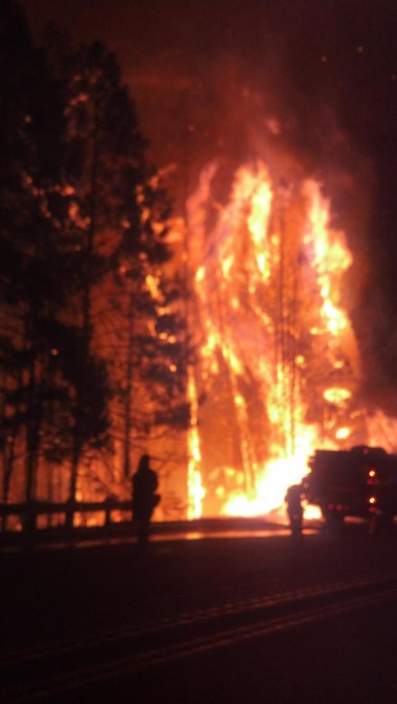
King Fire Arson Arrest Made
 |
| King Fire Arson Suspect Wayne Allen Huntsman |
Suspect Wayne Allen Huntsman, 37 held for arson, deliberately setting the King Fire and was being held in lieu of $10-million bail, according to the El Dorado County Sheriff's Office.Wayne Allen Huntsman was arrested in Placerville after investigators interviewed numerous people and developed multiple leads, El Dorado County Dist. Atty. Vern Pierson told reporters at a midday news conference.
The arrest was announced at a morning news conference in Camino attended by Calfire Director Ken Pimlott, U.S. Forest Service officials and the El Dorado County District Attorney Vern Pierson and Sheriff John D’Agostini.
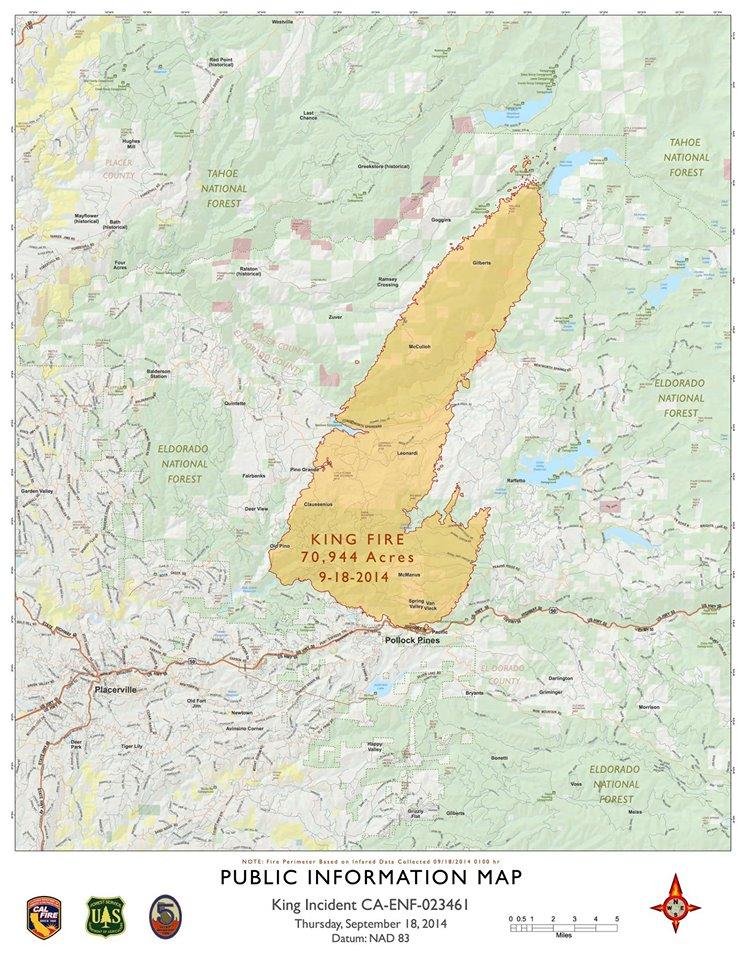
It was revealed at the news conference that the fire was set near Pollock Pines in very steep terrain. A Calfire investigator was the first to find the origin of the fire and begin the investigatory process that led to Huntsman’s arrest.
Pierson said that law enforcement had been in contact with the suspect in the days prior to his arrest in Placerville.
Huntsman will be arraigned at 1 p.m. Friday in El Dorado Superior Court.
---------------------------------------------The arrest was announced at a morning news conference in Camino attended by Calfire Director Ken Pimlott, U.S. Forest Service officials and the El Dorado County District Attorney Vern Pierson and Sheriff John D’Agostini.
It was revealed at the news conference that the fire was set near Pollock Pines in very steep terrain. A Calfire investigator was the first to find the origin of the fire and begin the investigatory process that led to Huntsman’s arrest.
Pierson said that law enforcement had been in contact with the suspect in the days prior to his arrest in Placerville.
Huntsman will be arraigned at 1 p.m. Friday in El Dorado Superior Court.
Officials would not say how they believe the fire was started, citing the ongoing investigation.