Wednesday, August 26, 2015

CA-SHU Democrat Fire, Trinity County, Democrat Gulch 2 miles west of Weaverville. #Evacuations

Democrat Fire, CA-SHU Democrat Fire, Trinity County, Democrat Gulch 2 miles west of Weaverville.

Evacuations in place from Oregon Mountain to Highway 299 and Oregon Street. Threat to communication infrastructure on Oregon Mountain.

Evacuations: Mandatory for the west side of Oregon Mountain down to Highway 299. Voluntary evacuation on Steiner Flat Road in Douglas City. Red Cross has established an evacuation shelter at the First Baptist Church 1261 S. Main Street in Weaverville. Road Closures: Oregon Street at Democrat Gulch to the top of Oregon Mountain 

08/26/2015 0715: 250 acres, 35% contained.

08/25/2015 1845: 180 acres, 0% contained. Threat to structures continues; evacuations continue. Fire continues to spot 1/4 mile ahead of the main fire.

08/25/2015 1700: 50 acres, 0% contained. 

08/25/2015 1600: 30 acres burning in brush and timber, 0% contained, moderate rate of spread. with spotting 300-400 hundred yards in front of the head.

Location: Fire is located on Oregon St. near Democrat Gulch, 2 miles west of Weaverville.
IA Acres: 1/2
IA ROS: Moderate
IA ROC: 1/4-1/2 acre in brush and timber, moderate potential upper 1/3 slope
Structures: are not currently threatened
Special Hazards:
Resources: SHU-BC 2415, E-2456, E-2455, E-2466, E-2476, E-2494, E-2465 Transport 2440 & 2444, ST9394G
Radio Frequencies: SHU local command tone 3, CDF Tac 11

Problems/Concerns: Private wireless and USFS communication site impacted by the fire

Tuesday, August 25, 2015

CA-LNU- Peterson Fire near Kelseyville, Lake County

Peterson Fire, CA-LNU- Peterson Fire - Lake County

The threat to structures in the area has been mitigated. There are no road closures or evacuation orders in place.

Peterson Fire
Credit: The Press Democrat ‏@NorthBayNews
Updates:
08/25,/2015 0645: 215 acres - 60% contained. Firefighters continue to work towards increasing containment and control. The mop up phase of fire control has begun while continuing to increase containment lines. The majority of air resources have been released. The area of the fire is rural country, which is steep, covered heavily in brush and with difficult access. 

Date/Time Started: August 22, 2015 5:30 pm
Location: off Peterson Lane and Adobe Creek Road, near Kelseyville, Lake County
GPS: Long/Lat: -122.879272/38.925764
Cause: Under Investigation
Resources: 
Total Fire Personnel: 252
Total Fire Engines: 20
Total Fire crews: 10
Total Helicopters: 1
Total Dozers: 4
Total Water Tenders: 2

CA-LNU- Grade Fire, Jerusalem Grade, Lower Lake, Lake County SRA

Grade Fire, CA-LNU- Grade, Jerusalem Grade, Lower Lake, Lake County SRA

A wildland fire has been reported in the Jerusalem Grade area. Near Jerusalem Fire Perimeter

GRADE FIRE
Credit: ken porter
Advisory Evacuation for the Jerusalem Grade area.
The Lake County Sheriff’s Office has issued an advisory for the possible evacuation of the area. The advisory includes:
Jerusalem Grade from Spruce Grove Road east to Canyon Road.
Spruce Grove Road from Jerusalem Grade Road north to Noble Ranch Road, which includes all of Black Bass Pass and East Road.
An evacuation advisory is not a mandatory evacuation, but it is strongly recommended. Residents are advised to gather their medications, pets and important papers. Residents should be prepared to leave the area with little notice.
Updates:
08/25/2015 1130: 25 acres and 95% contained.

08/25/2015 0900: 20 acres, 50% contained. 100+ firefighters assigned. 


08/25/2015 0600: 15 acres, MROS-RROS, Powerlines Down, 20 structures threatened. potential for 200 acres

Location: Jerusalem Grade and June Bug Road, northeast of Middleton (Lake County)
Problems/Concerns: Powerlines Down


Sunday, August 23, 2015

CA-BDF Summit Fire, CA-BDF-10399, Snow Summit in Big Bear City

Summit Fire, CA-BDF-10399, San Bernardino County, FRA

Snow Summit in Big Bear City

 orders for San Bernardino County  have been lifted 
 orders for San Bernardino County  have been lifted 
Summit Fire Evacuations: Mandatory evacuations for the Summit Fire in Big Bear City . The affected areas are: 
Knickerbocker Rd. and Pennsylvania, south and east to Mcwhinney Thursh Dr. 
Evacuation center for residents is at the Big bear Convention Center 
42900 Big Bear Blvd., Big Bear 

Summit Fire Updates: 
08/24/2015 0715: 100 acres, 30% contained
Threat to recreational infrastructure and Snow Summit.
Summit Fire in Big Bear City results in mandatory evacuations.

Mandatory evacuations for the following areas will remain in effect throughout the night:
Pennsylvania south between Knickerbocker Rd. and Jeffries/ All areas south of Oak between Jeffries and Eureka/ All areas south of McWhinney between Eureka annd Thrush Dr.

Voluntary evacuations are in effect for the following areas:
All areas north of Switzerland and south of Brownie/ Areas east of Thrush Dr. and west of Summit. 

08/23/2015 1345: Per AA 75 acres, "still within the box",


08/23/2015 1345: 30 acres, Per AA 25-30 Moderate to RROS. Structure threat in less than an hour. Potential for 250+

08/23/2015 1330: 10 acres, RROS spread to the east toward Snow Summit. ECC just advised AA they are UTF on 2 AT's and a VLAT at this time
IC requesting 2 county crews for immediate structure defense in the area of Knight and Pennsylvania.
MVU just sent both AT's off Ramona enroute to the fire. T-70 and T-71

Start time: 1225 hours
Location: 2N08 / Pine Knot
2 to 3 acres with potential to 10. 0% contained, moderate rate of spread with Spotting ahead of the fire.
Structure threats: Not currently
ROS: Moderate to rapid
ROC: Spotting 1/4 miles out, at least 10 spots per AA
IA WX: 84°, 19% humidity, wind NNW @4 mph

Saturday, August 22, 2015

Common Denominators For Wildland Firefighter Fatalities in the United States: 1990-2006

Wildland Firefighter Fatalities in the United States: 1990-2006

Common Denominators for Wildland Firefighter Fatalities

In the mid-1970s, fire researcher Carl Wilson identified four common denominators of fire behavior that caused fatalities and near-misses on wildland fires. These four common denominators have been cited for decades in fire safety training, in the "Fireline Handbook" (PMS No. 410–1), and in the "Incident Response Pocket Guide" (PMS No. 461).
Based on my analysis of 310 fire fatalities during wildland fire operations from 1990 to 2006, I believe that it is time to consider some 21st-century common denominators to help reduce wildland firefighter fatalities.
21st-Century Common Denominators for Wildland Firefighter FatalitiesAs the major causes of firefighter fatalities shift, additional factors need to be considered:
  1. Firefighters are most likely to die in an aircraft accident. Before every flight, fire managers must ask, "Is this flight essential?" and "Is everyone onboard essential to the mission?"
  2. Firefighters are nearly as likely to die in a vehicle accident as in an aircraft accident. Driving too fast for the conditions, failing to wear seat belts, rushing to a fire, and driving home while exhausted from firefighting kill firefighters.
  3. Firefighters can reduce their risk of dying from heart attacks on the job by staying fit, maintaining their body weight, and having regular medical checkups.
  4. Unexpected events such as falling snags, rolling rocks, downed power lines, and lightning strikes cause more than 8 percent of fatalities during wildland fire fighting operations. Firefighters and fire managers can reduce fatalities by learning to expect these unexpected events.
More than 20 percent of fatalities during wildland firefighting operations continue to occur in burnovers. Carl Wilson's original common denominators are just as important in the 21st century as they were in the 20th.
Carl Wilson's Common Denominators of Fire Behavior on Tragedy FiresThere are four major common denominators of fire behavior on fatal and near-fatal fires. Such fires often occur:
  1. On relatively small fires or deceptively quiet areas of large fires.
  2. In relatively light fuels, such as grass, herbs, and light brush.
  3. When there is an unexpected shift in wind direction or wind speed.
  4. When fire responds to topographic conditions and runs uphill. Alignment of topography and wind during the burning period should always be considered a trigger point to re-evaluate strategy and tactics.

Source: http://www.fs.fed.us/t-d/pubs/htmlpubs/htm07512814/page09.htm

CAL FIRE can impose new and tougher penalties after cheating scandal


Judge: CAL FIRE can impose tougher penalties after cheating scandal

Two of the three firefighters were able to quickly receive new promotions back to their previous rank of fire captain


The Associated Press

SACRAMENTO, Calif. — An administrative law judge says California’s firefighting agency can impose tougher penalties than were originally sought against three firefighters accused of cheating to obtain promotions.

The three were demoted in January during a scandal at the agency’s training academy in Ione, east of Sacramento, in the wake of a brutal murder. But two of the three were able to quickly receive new promotions back to their previous rank of fire captain.

The Department of Forestry and Fire Protection withdrew the initial disciplinary charges and filed new ones alleging dishonesty and willful disobedience.

Administrative law judge Douglas Purdy ruled that the new charges are not improper double jeopardy. The ruling was disclosed Wednesday in response to a public records act request.

The firefighters now will face new discipline. Firefighters’ union president Mike Lopez says the firefighters will appeal.

CA-YNP Yosemite Fire Update #13, Currently 8 Fires in the Park

Yosemite Fire Update #13, August 21, 2015

Currently no roads are closed within the park.  

Upper (37 45.534 x 119 35.983 – Mariposa Co., August 10).  This fire was discovered by hikers at approximately 3:30PM, August 10.  It is now out and in patrol status.  Quick action by the Yosemite Helitack, with supporting water bucket drops, and fire crews held the fire to 3.85 acres.  The fire was determined to be human caused and is under investigation. Smoke from the fire may continue to affect air quality in the morning hours.  All park trail closures associated with the Upper Falls fire were lifted at 6:00 PM 8/13.

Badger (37 40.697 x 119 39.316 – Mariposa Co., August 10).  This fire was discovered by Helicopter 551 in the area of Summit Meadows near Glacier Point Road.  Wawona Engine 32 responded and suppressed the 0.01acre fire.  It is in patrol status.

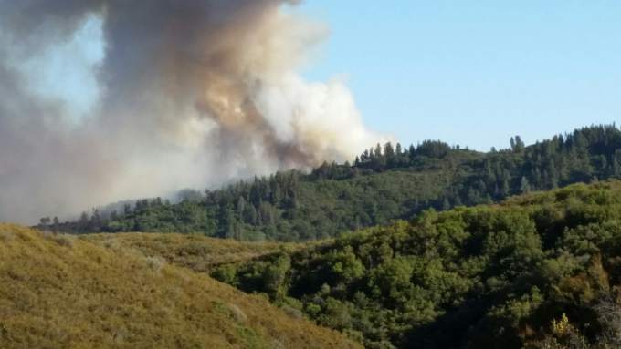
Lightning caused fires being monitored and managed for multiple objectives:  
Cathedral (37 51.078 x 119 25.120 – Tuolumne Co., 9400’El., 8/2). This is near the John Muir Trail to Cathedral Lakes.  The perimeter is actively smoldering and creeping through lodgepole pine needles and logs and has good potential to grow until it hits natural barriers.  The fire is 16 acres in size and is being monitored.  

Middle (37 51.538 x 119 41.194 - Tuolumne Co., 8043’El., 7/27). It is west of White Wolf and south of the Middle Tuolumne River.  It is at 14.1 acres, and smoke may be visible from Tioga Road. It continues to smolder and creep through down logs, pine needles and other vegetation.  It is in a red fir and lodgepole pine forest.

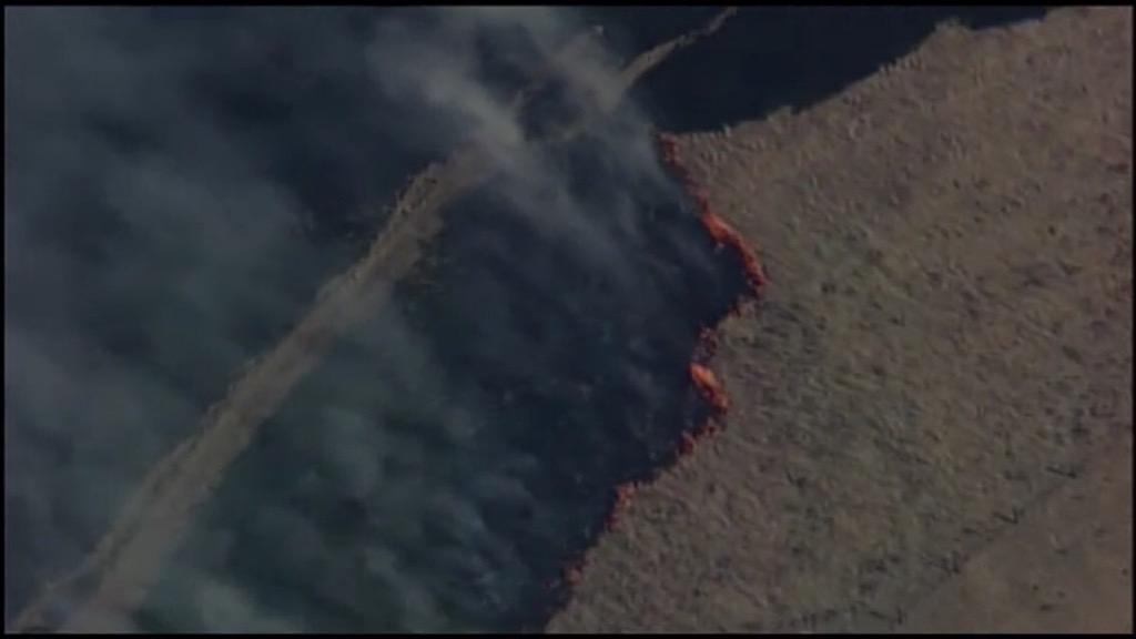
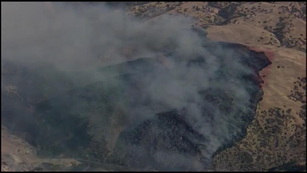
Dark (37 50.575 x 119 37.153 –  Mariposa Co.,8200’ el., 7/ 9). This fire is along the Yosemite Creek Campground Road and smoke is periodically visible from both the campground and Tioga roads. Fire crews secured the edges of the fire by burning along the most active perimeter.  That operation is complete. It is at 40 acres, and continues to creep and smolder through red fir duff and needles within the interior of the fire.  The Lukens trail is now re-opened. Fire crews will be parked and working Yosemite Creek Campground Road. For firefighter and visitor safety, drivers are urged to use caution while driving in the area of parked fire equipment.

White Cascade (37 54.926 x 119 23.780 - Tuolumne Co, at 9000’ el., 7/3).  This remote fire is east of Glen Aulin High Sierra camp, east of Conness Creek, and west of Tuolumne Meadows, and is at 8 acres. This high elevation fire, in a lodge pole pine forest, has a low spread potential. The fire is not near any trails.  Smoke may be visible in Tuolumne Meadows.

Quartzite (37 43.871 x 119 25.200 - Mariposa Co., 8387’ el., 7/27). It is approximately 0.5 miles south of Merced Lake, mid-slope and on a north aspect.  It is smoldering in mountain hemlock, western white pine and lodgepole pine. This fire is contained to natural barriers.

Stubblefield (38 02.743 x 119 36.625 – Tuolumne Co., 7659’ el., 8/3).  This fire is in Stubblefield Canyon and west of the Pacific Crest Trail and at the northeast section of the Park; it is very remote.  It is most likely a lightning strike holdover.  Currently, it is 2 acres in size, in a red fir and Jeffrey Pine forested area, with other sparse vegetation.  

Air Quality in the park is being affected by numerous fires throughout California. For more information refer to the web sites listed below.  Currently no roads are closed within the park.  

All visitors are urged to be diligent in any use of fire, including smoking.  And be sure all fires are out!

As with all fires, staff and visitor safety is of paramount importance.  Each fire, regardless of size, is assessed for the appropriate course of action.

For More Information
Nixle -  Emergency Alerts and Updates– www.nixle.com Photo credit: Wikipedia Commons

Friday, August 21, 2015

NIFC News: Australia and New Zealand Firefighters ExpectedSunday In Boise For Western Wildfire Assignments

The National Interagency Fire Center in Boise announced Thursday that top fire managers representing various U.S. Wildland Fire agencies requested about 70 fire managers and specialists from the two countries.

With the nation still at wildfire preparedness Level 5 — the highest there is — and spending $ 150 million per week fighting fires, Australia and New Zealand are sending firefighters to help battle wildfires burning in the western United States.

The United States has also sent its own firefighters to these countries when they need aid: 67 to Australia in 2007 and 73 in 2009.

Details are still being worked out, but the firefighters are expected to arrive in Boise on Sunday. After a one-day orientation to learn about current fire behavior they will be assigned to large fires.

This is not the first time that the United States has relied on firefighters from so far away. There’s a history of such international collaboration with Australia and New Zealand, going back to the year 2000, which the National Interagency Fire Center says is “the first time their firefighters fought fires on American soil.”

The last time the U.S. asked for help from Australia and New Zealand was in 2008.

NIFC MOBILIZES AUSTRALIAN AND NEW ZEALAND FIREFIGHTERSTO HELP WITH WESTERN WILDFIRES

 Boise, Idaho – Top wildland fire managers at the National Interagency Fire Center (NIFC) in Boise, Idaho are mobilizing firefighters from Australia and New Zealand to assist with wildfire suppression efforts in the western United States. Australia and New Zealand have been key partners with the U.S. fire community for more than 50 years but were last mobilized in 2008 when severe fire activity was similar to this year.


The National Multi-Agency Coordinating Group (NMAC) comprised of top fire managers representing the Bureau of Land Management, Bureau of Indian Affairs, the National Park Service, and the U.S. Fish and Wildlife Service, the U.S. Forest Service, the U.S. Fire Administration and the National Association of State Foresters, requested approximately 71 fire managers and specialists. Although final details of the arrangement are being worked out, the contingent from Australia and New Zealand is expected to arrive in Boise, Idaho on August 23 for a one-day induction to learn about current fire behavior, fuels and weather conditions. Upon completion of this orientation, they will be assigned to large fires that are currently burning.


“We are very appreciative of the Australian and New Zealand firefighters for their availability to assist us with our current fire situation,” said Aitor Bidaburu, Chair of NMAC. “We currently remain at National Preparedness Level 5, our resources are fully committed and there are no season-ending weather events in the foreseeable forecast. Because of the current level of commitment and forecast, having fire management expertise from Australian and New Zealand firefighters will be of tremendous help as we continue suppressing ongoing fires.”


The request includes 15 Division Supervisors; 15 Task Force/Strike Team Leaders; 15 Helicopter Managers; 10 Heavy Equipment Bosses; 10 Safety Officers; 4 Regional Liaison Officers; and two National Liaison Officers. Fifteen of the total are from New Zealand. Assistance from Australia and New Zealand is a good fit primarily because their fire organizations are very similar to the United States national fire organization in training requirements and structure.


Large fires are continuing throughout the West, particularly in the Northwest, Northern Rockies, Northern California, Southern California and Great Basin Areas. Approximately 93 uncontained large wildfires are currently burning on more than one million acres in Oregon, Washington, Idaho, Montana, California, Nevada, Texas and Arizona.


The National Preparedness Level remains at 5, the highest level, indicating a high level of wildfire activity and a high level of commitment of available wildfire suppression assets, such as firefighters, aircraft, and engines. Weather and fuel conditions are predicted to continue to be conducive to wildfire ignitions and spread for the next few weeks.


In 2008, the last time Australia and New Zealand firefighters assisted the U.S. with wildfire suppression, 49 fire managers and specialist spent 37 days in California. The time before that was during the 2006 fire season when 120 firefighters from Australia and New Zealand came to the U.S. to assist with efforts in the West. Prior to that, they have also assisted during the 2000, 2002, and 2003 fire seasons and U.S. firefighters traveled to Australia to assist with their fire seasons in 2010, 2009, 2007 and in 2003.


In addition to the Australia and New Zealand support, Canadian firefighting assets are currently assigned to the Northern Rockies Geographic Area. Five wildland fire suppression crews from Ontario, Canada and one Convair 580 airtanker group from both Saskatchewan and Alberta are supporting fire suppression efforts in Montana and northern Idaho.

###

More Media Info:
 http://www.washingtonpost.com/news/energy-environment/wp/2015/08/21/why-the-u-s-just-summoned-firefighters-from-australia-and-new-zealand/
Pic credit: Rueters 

Wednesday, August 19, 2015

CA-SCU- Tesla Fire, Vegetation Fire, Alameda County [MAPS]

Tesla Fire, CA-SCU-Tesla, Vegetation Fire, Alameda County

Fast moving vegetation fire burning in Livermore hills east of Livermore Laboratory and Carnegie State Off-road Vehicle Park burning on both sides of Tesla Rd. Carnegie Park has been evacuated.

Updates:
08/21/2015 0900: 2,500 acres -  75% contained 

08/20/2015 1600: 2,500 acres - 45% contained 

08/20/2015 1100: Mapped 2500 acres, AA return at 1600hrs during heat of the day, Dozer or handline all the way around fire.
CA-SCU TESLA FIRE TOPOGRAPHIC LOCATION MAP 8-20-15
CA-SCU TESLA FIRE TOPOGRAPHIC HOTSPOT LOCATION MAP 8-20-15
CA-SCU TESLA FIRE TOPOGRAPHIC LOCATION MAP
CA-SCU TESLA FIRE TOPOGRAPHIC LOCATION MAP 8-20-15
Tesla Fire, CA-SCU-Tesla, Vegetation Fire, Alameda County

Tesla Fire Perimeter and Hotspot Map

08/20/2015 0700: 2500 acres - 25% contained One uninhabited structure destroyed, 


Tesla Fire
Credit:  
08/19/2015 2025: per AA 2500 acres, 5% contained. Copter 106 to Livermore, 912 to Castle, Bravo 58 to McClellan AA230 released all aircraft off the fire and accounted for.
08/19/2015 1915: 1500+ acres, Pulling Resources from the north end of the Sac Valley to fill and backfill incident resource orders. Onshore winds are a factor in the spread of this incident.
08/19/2015 1830: 1000+ acres
08/19/2015 1810: 800+ acres, Tam Crew on scene, four Golf ST's ordered...

Tesla Fire Location Map 08/19/2015
Grass fire is burning east of Livermore off Tesla Rd, photos via Chopper 11.
08/19/2015 1750: 500+ acres, AA received permission to use restricted airspace above LLNL site 300
08/19/2015 1730: LG ST 2310 c assigned, Powerlines are a problem for aircraft, 1 copter working head of fire ahead of structures, 1 copter inbound. AA440 Tanker 912 inbound eta 1743,  AA230 now lead... restricted airspace area over lab.... AA reports fire at 200 acres, likely to go to 400.
08/19/2015 1700: 200+ acres. 0% contained. Fire is burning toward Site 300, a no-fly zone for aircraft.


08/19/2015 1615: 200 acres.  0% contained. Burning in grass at a dangerous spread rate. 500kv power lines threatened. Fire is located 11 miles east of Livermore in Alameda county. VLAT 912 en route to the fire now. 4 S2's currently working the fire. LNU 9144C en route to the fire immediate need- to form up at the scene.

08/19/2015 1600: Requesting VLAT or a large airtanker that does not need a lead plane. Lead for VLAT will be out of Redding which will delay use of VLAT.

Date Started: August 19, 2015 2:45 pm Location: Tesla Rd and Corral Hollow Rd. Altamont pass

IA Acres: 100+
ROS: Rapid
ROC: IC reporting 100 plus acres fire is on both sides of  Corral Hollow Road
Structure Threats: not currently 
Resources: LNU 9144C(I believe) enroute to the fire immediate need to form up at the scene
Online Scanner: http://www.broadcastify.com/listen/feed/17667/web
Cause:Under Investigation 
Total Fire Personnel:257  
Total Fire Engines:53  
Total Fire crews:4  
Total Dozers:6  
Total Water Tenders:2  
Long/Lat:-121.3732/37.3845  

CA-ANF Warm Fire, Vegetation Fire, Los Angeles County

Warm Fire, CA-ANF-3651, Vegetation Fire, Los Angeles County, FRA

Updates: 
08/19/2015 0900: 300 acres, brush, 100% contained. [FINAL]
  Type 3 IC (Alarid) in command
08/18/2015 0900: 300 acres, brush, 50% contained
Type 3 IC (Alarid) in command
500 KV lines in the area
Lake Hughes Road closed.

08/17/2015 0900: 300 acres, brush, 10% contained
500 KV lines in the area

Lake Hughes Road closed

Location: Warm Springs Rd x Lake Hughes Rd, North of Lake Castaic
 Los Angeles County, FRA

CA-INF Walker Fire Mono County. FRA

Walker Fire, CA-INF-001319, Mono County. FRA

Lee Vining and June Lake Loop remain on 24 hr. evacuation notice.Campgrounds in Upper and Lower Lee Vining Canyon are closed.

Updates:
 08/19/2015 0810: 3,715 acres, 35% contained
Type 3 Great Basin IC (Rasner) in command. Incident in unified command with Mono Co. Sheriff’s Dept.

Location: Walker Lake north of June Lake Loop FRA

CA-KRN Deer Fire, CA-KRN-030112, Kern County SRA

Deer Fire, CA-KRN-030112, Kern County SRA

Vegetation fire 

Updates: 
08/19/2015 0900: 200 acres, 60% contained, Forward progress has stopped. Type 4 IC (Shoemaker) in command. Threats to Bear Valley community, approx. 200 homes with potential for more if fire reaches east drainage.

Location; Hwy 58 x Hwy 223, Tehachapi, Kern County
Start time: 19:40 on 08/18/2015

Tuesday, August 18, 2015

CA-SLU Cuesta Fire, San Luis Obispo County State DPA, SRA, FRA

Cuesta Fire  CA-SLU-008555, San Luis Obispo County State DPA, SRA,FRA

Mandatory evacuations have been issued for Hwy 58 south of town of Santa
Margarita and all of Miller Flat area.

Cuesta Fire Perimeter and Hotspot Map
Updates:
08/19/2015 0900: 2,500 acres, grass, 15% contained
  • CAL FIRE IMT 4 (Derum) has assumed command.
  • Incident in Unified Command with CAL FIRE and USFS
  • Threat to the community of Santa Margarita, high voltage power lines, and
    local power infrastructure.
  • Fire is impacting Union Pacific Railroad operations and Highway 101

08/18/2015 0900: 2,000 acres, grass, 10% contained
Incident in Unified Command with CAL FIRE and USFS
CAL FIRE IMT has been ordered.
Threat to the community of Santa Margarita
Mandatory evacuations have been issued for Hwy 58 south of town of Santa
Margarita and all of Miller Flat area.
230 KV power lines threatened
40-50 acre plot on Los Padres Wilderness area on Cuesta Ridge

08/17/2015 1930:  500 acres, grass, 5% contained
Incident in Unified Command with CAL FIRE and USFS
Threat to the community of Santa Margarita
Evacuations order issued to southern Santa Margarita
230 KV power lines threatened
VLAT was utilized
Type 3 XSL-IMT has been activated
County EOC activated
40-50 acre plot on Los Padres Wilderness area on Cuesta Ridge
08/17/2015 0900: 125 acres, grass, 10% contained
60 KV lines in the area
Communication lines threatened

08/16/2015 1940: 
25 acres, grass, 0% contained. Moderate Rate of Spread
IA Wx: 76 degrees, 55% RH, wind NNW @ 8, increase with gusts to 21
Location: Highway 101, Cuesta Grade, North of San Luis Obispo - 3 separate fires along Cuesta Grade  
Highway 101, Cuesta Grade, North of San Luis Obispo, State DPA, SRA
Start Time: 1813
Problems/Concerns: 60 KV lines in the area, Communication lines threatened,  Northbound Highway 101 closed

Wildland Fire News: Large Air Tankers Seen As Firefighting Savior?

Large airtankers seen as firefighting savior, but not everyone agrees

Picture a plume of wildfire smoke rising from foothills, looming ominously over a city below. Residents, who can't see much from their homes but smoke and flame, finally see something that brings them hope: a massive airtanker passing over the fire, dropping a long plume of red retardant.

airtanker fire
An airtanker makes a drop on the Colby fire in Azusa, Calif., on Thursday, Jan. 16, 2014.
By Ryan Maye Handy
The Gazette (Colorado Springs, Colo.)


COLORADO SPRINGS (Tribune News Service) — Airtankers soaring over a wildfire offer some of the most iconic images of firefighting around the world. During Colorado's record-breaking summers of wildfire, large airtankers were heralded as the salvation of firefighting efforts; they remain symbols of victory, of winning a battle against encroaching flames. Even while hundreds of fire crews worked deep in the forests, airtankers were the most obvious and powerful sign something was being done to stop the wildfire.

But airtankers the sizes of passenger planes are not a panacea, experts say. Their role is often poorly understood by the public, their effectiveness poorly understood by researchers. The planes can be tricky to work with because they can't always fly in mountainous terrain, and heavy retardant drops can be a safety hazard for firefighters below.

Nonetheless, as wildfires char much of the drought-stricken West, airtankers have become essential to wildland firefighting. The tankers are more sophisticated than ever, and bigger planes can fly farther with greater loads than their predecessors.

Last week, the Colorado Springs Airport announced it will become the home base of the country's largest and newest airtanker, a 747-400 Boeing Converted Freighter, which can fly with 19,600 gallons of retardant for 4,000 miles. City officials hope it will also bring more business to the flagging airport, which recently lowered its operational costs in an attempt to attract businesses like the plane's owner, Global SuperTanker Services LLC.

But experts caution that there's more to the supertanker than meets the eye. Many of the country's most impressive airtankers are privately owned and work on a contractual basis — and the 747 is the most expensive. While research has shown that large airtankers — which carry more than 3,000 gallons — can be effective, little research has been done on so-called supertankers like the 747.

While airtankers are crucial to firefighting efforts, their use is subject to much political pressure, said Robert Gray, a Canadian fire ecologist who also studies firefighting techniques.

"If people don't see the big airtanker, they assume that you aren't throwing all the possible airtankers at the fire," said Gray. "People equate airtankers with big success."

Bigger not always better

Airtankers have long been a crucial in battling wildfires, but as older planes retire and wildfires become more frequent, more large airtankers are taking to the skies. All tankers have their drawbacks, but some say that passenger-plane sized aircrafts have more limitations.

Studies have shown that largest airtankers are more affected by bad weather, and can't fly or drop as accurately over steep terrain. While a handful of big planes are frequently used to fight wildfires, the 747 has the least experience. Research from the U.S. Forest Service and NASA has questioned whether the 747 is effective in rugged terrain.

"In the process of bringing in the large airtanker, you have to pull resources off, and if it's in the timbered area they can't immediately go back in because it's not safe," Gray said. "You can't get people back on the fire quickly. The effectiveness is the combined ground resources with the air resources — air support isn't going to stop the fire."

Despite concerns about its maneuverability and size, the plane offers something unique: its nearly 20,000-gallon capacity and ability to make multiple drops.

While weather and landscape might limit where the plane can fly — it might not be the best choice to fight a fire up a mountain pass — it can fly farther than other airtankers. And the 747 can be always at the ready because it can sit fully loaded on a tarmac. Most planes must dump their loads immediately due to weight concerns.

Airtankers of different sizes have different roles in firefighting. Some single-engine tankers can carry fewer than 1,000 gallons of retardant but are more maneuverable. A DC-10 can carry around 12,000 gallons and works best on flat-land fire, such as the 2013 Black Forest fire.

Many airtankers used by the Forest Service were converted military aircraft from the 1940s and 50s, but the need for an updated fleet has pushed the Forest Service towards hiring privately owned newer and larger planes like the 747.

Before an airtanker drops, crews on the ground help those in the air determine the distance, breadth and force of the drop. When it comes time for a tanker to make a drop, crews get out of the way.

No airtanker will drop if they are likely to hit people

Retardant loads are much heavier than water, and when propelled by gravity they have been known to down trees. That's one complication that the new 747 supertanker won't create, said Jim Wheeler, president and CEO of Global SuperTanker Services. The plane uses a pressurized system for deploying retardant, which means that a drop feels like a heavy rain instead of gravity-propelled 8.5-pound per gallon dump, Wheeler said.

"If you get hit with that there is no need for a funeral, you are buried," he said.

Gray is concerned that a "heavy rain" pressurized fall won't penetrate thick forests, but Wheeler is confident that the 747's drops will have no problem getting through the forest.

Although there has been much criticism of the larger tankers — the Forest Service canceled several contracts in 2004 over safety concerns — the planes have generally been successful,

"NASA did a study of large airtankers, and they were very discouraging about the use of large air tankers," he said.

Use of big planes like a DC-10 has proved that large-capacity planes do help, however.

"But they've been proved completely wrong,"


Worth the cost?
Continues...

Twitter Buttons

****REMINDER**** Every fire has the ability to be catastrophic. The wildland fire management environment has profoundly changed. Growing numbers of communities, across the nation, are experiencing longer fire seasons; more frequent, bigger, and more severe, fires are a real threat. Be careful with all campfires and equipment.

"I am a firm believer in the people. If given the truth, they can be depended upon to meet any national crisis. The great point is to bring them the real facts, and beer." --Abraham Lincoln

View blog top tags
---------------------
CLICK HERE TO GO BACK TO TOP OF CALIFORNIA FIRE NEWS HOME PAGE

Subscribe via email to California Fire News - Keep track of Cal Fire News

Enter your email address:

Delivered by FeedBurner