Acres Burned: 24,251 acres
Containment 24,251 acres - 100% contained
Structures Destroyed: 10 outbuildings have been destroyed
6 damaged commercial properties, and 6 damaged outbuildings.
Evacuations: All evacuations have been lifted.
Injuries: 10
Cause: Under Investigation
Current numbers for the Springs Fire 5-8-13 0900:
Acres: 24,251 *
Containment: 95%
Assigned Personnel: 247
Injuries: 9 (all minor)
Homes Damaged or Destroyed: 0
As vegetation begins to dry out following the light rain over the fire area, hot spots are beginning to ignite and produce smoke in the interior of the burn area. Firefighters will continue to patrol and mop up these areas throughout the day.
*Firefighters have now had a chance to walk the entire perimeter of the fire with GPS equipment and accurately measure the fire's area. With that the acreage total has been reduced to the new number listed above.
Update 5-8-13 1700: 24,251 acres - 96% contained
Full containment expected tomorrow.
Update 5-8-13 1700: 24,251 acres - 96% contained
Full containment expected tomorrow.
Current numbers for the Springs Fire 5-7-13 1700:
Acres: 28,000Containment: 95%
Assigned Personnel: 296
Injuries: 9
Homes Damaged or Destroyed: 0
Firefighters continue to locate hot spots within the burn perimeter. The main focus of operations continues to be to eliminate heat inside the perimeter that may cause an escape, finish fire line construction, and rehabilitate the ares impacted by fire suppression.
 |
| After the fire...life returns (Photo taken in Camarillo Springs - Ventura County Fire Department) |
Acres: 28,000
Containment: 90%, full containment expected today!
Assigned Personnel: 440
Injuries: 8
Homes Damaged or Destroyed: 0
Today, firefighters will continue to mop up (extinguish hot spots and flare-ups) and patrol the fire perimeter. Fire suppression repair and rehabilitation continue. Firefighting resources will continue to be demobilized.\
Update 5-6-13 0700: Arson Ruled Out - Investigators ruled out arson as the cause of the fire that charred 44 square miles at the western end of the Santa Monica Mountains. Instead, they believed it was started by a small, "undetermined roadside ignition of grass and debris" on the edge of U.S. 101 near Thousand Oaks, said Tom Piranio, a spokesman with the California Department of Forestry and Fire Protection.
"The topography plus the hot, windy weather created a perfect storm for the fire to spread fast," he said.
The area near an uphill incline is considered a collection point for fuel and ignition sources, and it's possible a piece of debris fell into the tinder-dry brush early Thursday and sparked the fire, Piranio said.
Acres: 28,000
Containment: 80%, full containment expected May 7.
Assigned Personnel: 1,055
Firefighter Injuries: 8
Homes Threatened: 0
Homes Destroyed: 0
No significant fire behavior observed overnight, and little to none is expected today with rain in the forecast.
 |
| Picture From Camp Pendleton Fire Department |
UPDATE 0830 5-5: Acres: the fire remains at 28,000 acres.
Containment: hard work by the firefighters yesterday and overnight has increased containment to 60%.
Injuries to firefighters: 5, all minor. Two falls, three with debris in their eyes.
Personnel assigned: 1,856. This includes 212 fire engines and 6 helicopters. It is expected that the de-mobilization process will begin today and some firefighters will be sent home or to other fires.
Evacuations and Roads: all evacuation orders have been lifted. Potrero Rd. is open to residents with ID. Hidden Valley residents are encouraged to use the Westlake access to return home.UPDATE 1630 5-4: 28,000 acres - 56% contained Containment expected May 6th..
UPDATE 0230 5-4: Burning Ops all night the lines held. interior did not burn as much as hoped.
UPDATE 1530 5-4: With the milder weather conditions firefighters are making excellent progress on extending fire containment lines. The fire remains at 28,000 acres and that figure is not expected to change significantly. Cal Fire Incident Management Team 5 is managing the incident A revised map showing the total footprint of the fire is now posted below. The red line indicates the outer edges of the fire. The blue lines show evacuation areas. Evacuation orders in these areas may have been lifted.
 |
| CA-VNC-SPRINGS |
 |
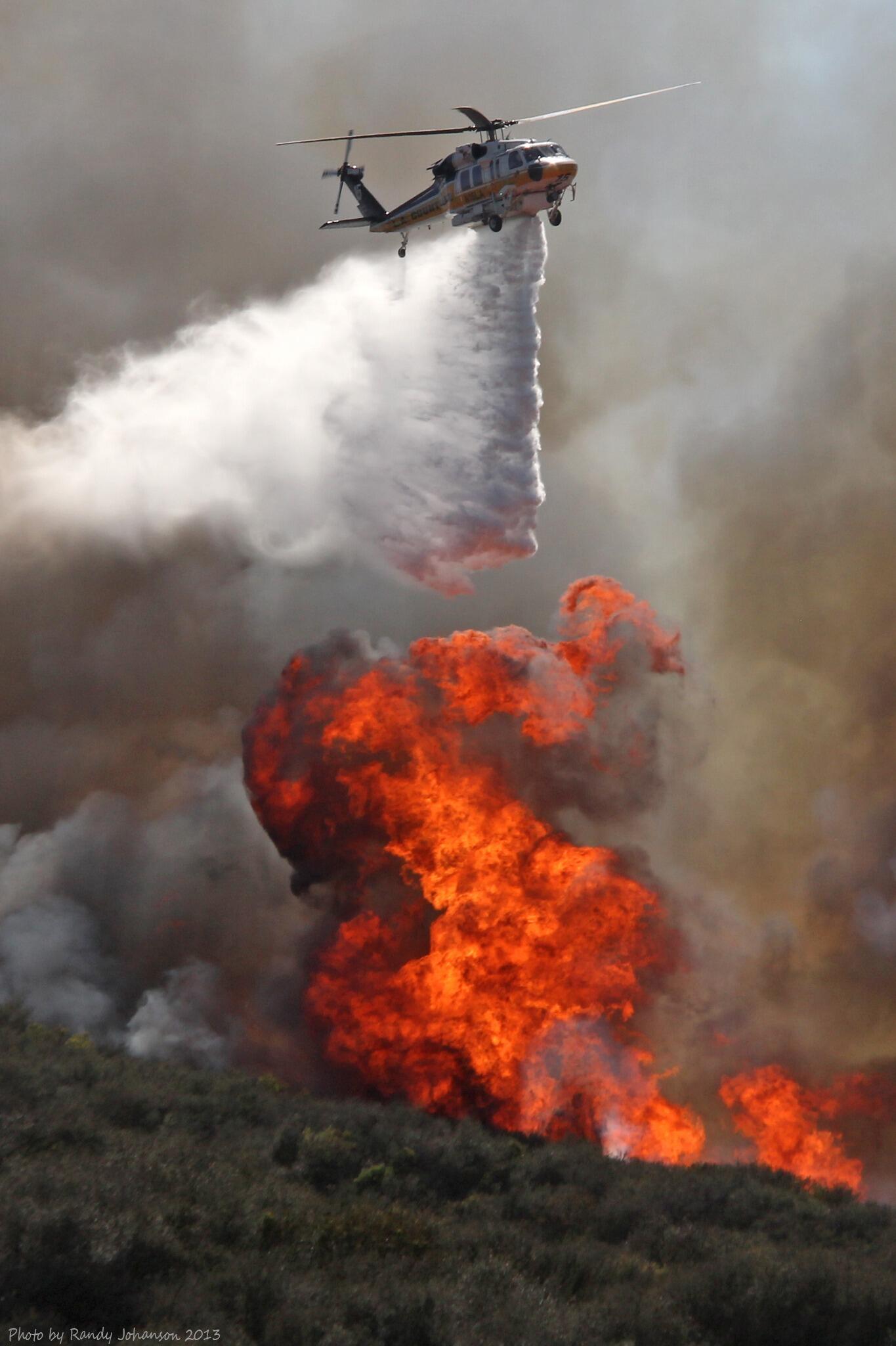
| #LACoFD Copter 15 makes a drop on the #SpringsFire in Camarillo Credit: Randy Johanson @kingsrule24 |
Acres: 28,000
Containment: 30%
Homes Threatened: 4,000, 15 damaged, none destroyed.
Assigned Personnel: 1,895
Injuries: 1 firefighter, 1 civilian, both from a traffic collision away from the fire.
Roads/Evacuations:
Pacific Coast Highway - Open!
Potrero Rd. - Closed
Deer Creek Rd. - Closed, evacuation orders still in place.
Yerba Buena Rd. - Closed evacuation orders still in place.
All Newbury Park Evacuation Orders - Residents only allowed in with valid ID.
Potrero Rd. - Closed
Deer Creek Rd. - Closed, evacuation orders still in place.
Yerba Buena Rd. - Closed evacuation orders still in place.
All Newbury Park Evacuation Orders - Residents only allowed in with valid ID.
Weather: cooler, higher humidity

Be Safe Guys fighting The front Lines, we support you, please redirect any Bambi's running amuck to Safety.
ReplyDeleteAgain Thank You; God Bless
Humboldt County / Shelter Cove Resident
Gene Paliescheskey