Spring Peak, NV-HTF-30475 Mineral County, Nevada Wildfire NE of Mono Lake CA, FRA
MODIS shows this fire has crossed into California just east of Bodie.
MODIS shows this fire has crossed into California just east of Bodie.
 |
| #SpringPeak Fire @HumboldtToiyabe 12,000 acres 0% cont'd; #Bodie closed http://inciweb.nwcg.gov/incident/3668/ #NVFire #CAFire pic.twitter.com/qj4XxZh96L |
Update 8-26 1900: 14,200 acres - 100% contained
Update 8-23 1900: 14,200 acres 85% contained
Type 3 Team (Brown) is in command of this incident.
Bureau Land Management, USFS, CALFIRE, and many other cooperators continue to support this incident with resources.
Update 8-23 0900: 14,200 acres 72% contained
Type 3 Team (Brown) is in command of this incident.
Increased sustained winds continued to cause flare ups within interior and perimeter; this resulted in breaches of containment lines into unburned fuels outside of the lined areas of the fire.
Update 8-22 1900: 14,200 acres 68% contained
Type 3 Team (Brown) is in command of this incident.
BLM, Bishop Field Office, CALFIRE, and USFS supporting this incident with resources.
Fire West, Southwest, Southeast spread potential reduced as containment lines are being created.
Threat to high energy power transmission lines owned by LADWP. Critical communication tower for NDOT, NHP, Mineral County emergency and municipalities in the area.
Increased sustained winds continued to increase fire activity in the interior and perimeter areas resulting in breaches of containment lines into unburned fuels outside the lined areas of the fire.
Direct attack using ground crews and air resources.
Update 8-22 0900: 14,200 acres 68% contained
Type 3 Team (Brown) is in command of this incident.
BLM, Bishop Field Office, CALFIRE, and USFS supporting this incident with resources.
Fire West, Southwest, Southeast spread potential reduced as containment lines are being created.
Significant progress made in overall containment efforts due to added resources and favorable weather and precipitation
Update 8-21 1900: 14,200 acres 68% contained
BLM, Bishop Field Office, CALFIRE, and USFS supporting this incident with resources.
Significant progress was made today in containment efforts. Direct attack was made on the fire using ground crews and air resources; with an emphasis on protecting the cultural resources in the area and the town of Bodie. Great effort is being made to keep any fire out of the critical bi-state Sage Grouse habitat.
Update 8-21 0900: 14,300 acres 20% contained
Minimal fire behavior in the morning with increased activity in the afternoon related to the thunderstorms.
Update 8-20 1900: 14,300 acres 20% contained
BLM, Bishop Field Office, CALFIRE, and USFS supporting this incident with resources
Update 8-20 0900: 12,000+ acres 0% contained
Update 8-19 1900: 12,000 acres 0% contained
Update 8-20 1900: 14,300 acres 20% contained
BLM, Bishop Field Office, CALFIRE, and USFS supporting this incident with resources
Update 8-20 0900: 12,000+ acres 0% contained
Update 8-19 1900: 12,000 acres 0% contained
Fire is still very active. Continued torching and small runs were experienced. The same resources are still threatened.
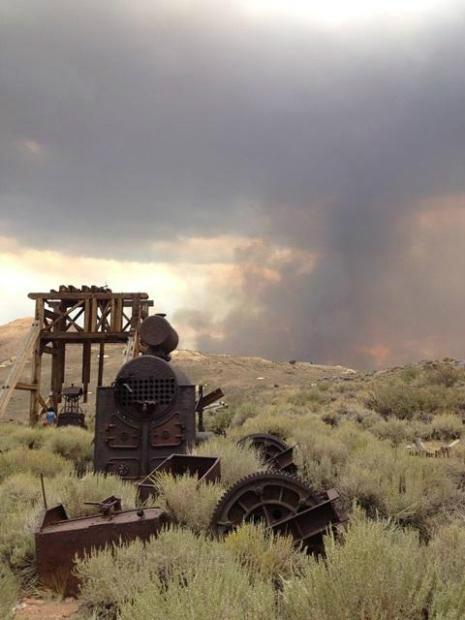
A concern for firefighter safety due to historical abandoned mining operations in the fire area.
Update 8-19 0900: 3,500 acres 0% contained
Threatening the historical mining town of Aurora and the Aurora Cemetery. Active Borealis and Esmeralda mining sites threatened. Critical communications tower for NDOT/NHP and Mineral County Municipal agencies threatened. Bi-State Sage Grouse habitat. Cultural and historic resources threatened.
Update 1800: 1000 acres, 0 % ContainedIncident Overview
The Spring Peak Fire was first reported on August 18 at approximately 10:39 a.m. Lightning on August 17 is the primary cause. The fire is burning in light, flashy fuels and is wind-driven.Historical mining structures and the cemetery at the old Aurora townsite and several active mines in the area are threatened. A Sierra Front Type III Incident Management Team has been ordered and is scheduled to take over management of the fire at 8:00 p.m. on Sunday evening (8/18).
Basic Information
Incident Type: Wildfire
Cause: Lightning
Date of Origin: Sunday August 18th, 2013 approx. 10:30 AM
Location: 15 miles NE of Mono Lake; 30 miles SW of Hawthrone, NV
Incident Commander Brown
Current Situation
Total Personnel: 119
Size: 3,500 acres
Estimated Containment Date: Sunday August 25th, 2013 approx. 06:00 PM
Fuels Involved - Grass, brush, pinyon pine and juniper.
Fire Behavior - Extreme, wind-drivenOutlook/Planned Actions - Additional resources in-route
Growth Potential - High
Terrain Difficulty - Medium
Remarks - The fire has impacted a major powerline that services the Pacific Northwest.
Current Weather
Wind Conditions 25 mph SW
Temperature 85 degrees
Humidity 15%
Location: 15 miles NE of Mono Lake; 30 miles SW of Hawthrone, NV
IA: *
ROS: *
ROC: *
Structure Threats: *
Concerns: *
Resources:
Cooperating Agencies: *
Weather Info: *
Special Conditions: *
Other Comments: *
Radio Frequencies: *
Maps: *
Agency Website: *
Online Scanner: *
Live Video: *
Web Cams: *
---------------------------------------------
This blog is so nice to me. I will keep on coming here again and again. Visit my link as well. Retail Cleaning Madison MS
ReplyDelete