CFN - CALIFORNIA FIRE NEWS - CAL FIRE NEWS


CALIFORNIA FIRE NEWS - California News with Focus on Firefighting, Firefighters and Wildland Fires throughout the state. The Real Scoop Fire News When You Need It. CAL FIRE news, Fire & EMS News, Wildfire Intel, Structure Fires, Vehicle fires, Haz-Mat, Earthquakes, SAR, Wildfires, Floods, Firefighter Jobs, Public Safety Information

Wednesday, November 1, 2017

Local News: After the wine country fires, what happens to the crops?

In one week, more than 2 million gallons of retardant were dropped in California—a record, according to Cal Fire, the state firefighting agency.

Memories are short. Despite claims to the contrary, wildland fires along California’s west coast and inland valleys have not changed much since the 1964 Hanley Fire, a blaze which burned nearly the same territory as the Tubbs Fire but was even larger. What has changed is human demography.

After the wine country fires, what happens to the crops?
By Julie Cart | Oct. 31, 2017

 The full extent of the damage from the northern California wildfires that killed 43 people and destroyed 8,400 homes is still being tallied. The devastation left an obvious scar, but not all the damage is visible.

Among the assessments still to be made is what impact millions of gallons of fire retardant—essentially a potent fertilizer—may have on carefully tended plants and soils.

Saved by timing, nearly 80 percent of the renowned wine region’s grapes had been harvested when the multiple fires started in early October. And for the most part, the blazes did not linger at the vineyards, which are kept free of grasses and other fire-devouring fuels.

But there was collateral damage: bright red slathers of fire retardant dropped from the state’s fleet of supertankers. In one week, more than 2 million gallons of retardant were dropped in California—a record, according to Cal Fire, the state firefighting agency.

“We are always mindful of where we are trying to drop aerial fire retardant,” said Chris Jurasek, the Cal Fire aviation supervisor who directed many of the drops. “It’s always in our mind to try and alleviate contacting anything other than fire.”

Cal Fire has the largest aerial firefighting fleet in the world. As planes become increasingly central to fighting fires in California, more and more retardant is served up.

On one day during the recent fires, Oct. 12, crews loaded nearly 700 gallons of retardant a minute from dawn to dusk to help slow the fire, according to Cal Fire. By way of comparison: The state’s largest aviation facility, near Sacramento, pumped 1.7 million gallons of retardant into firefighting tankers in 2016. The base has already used more than 4 million gallons so far this year.

The retardant, called Phos-Chek, contains ammonium phosphate, a fertilizer. It also includes chemicals to regulate how the slurry drops, emulsifiers that render it gooey so it sticks to targets, and a coloring agent so air crews can track what they’ve dropped. For the most part, the ingredients are disclosed to Cal Fire by the Phos-Chek manufacturer, ICL-Performance Products, LP. But the entire formula is not made public.

George Matousek, an ICL chemist who helped formulate the retardant, said the precise recipe is a trade secret but “all products in Phos-Chek are food-grade or better.”

The chemicals are mixed with water and are generally harmless to humans and most animals, according to the company. But retardants are known to be toxic to fish, so state and national fire-fighting agencies prohibit drops within 300 feet of water sources. But as Western wildfires increasingly move out of forests and into developed areas, firefighters have less wiggle room to target their drops.

When a converted 747 jetliner is lining up to release nearly 20,000 gallons of retardant, there’s no guarantee of precision. Pilots are often guided away from water sources and landscapes containing plants that are endangered or otherwise protected by law, using retardant avoidance maps published by the U.S. Forest Service.

It’s an issue that’s taken seriously by fire-fighting agencies. Biologists say that a sudden dump of nutrients in soils can encourage the growth of non-native or invasive plants.

“There is a precedent for concern about soil chemistry,” said Andy Stahl, executive director of Forest Service Employees for Environmental Ethics, a watchdog group made up of Forest Service employees and others. Improving soil productivity “would allow invasive plants that are better able to utilize these nutrients (to) crowd out natives.”

How those interactions might play out in carefully curated vineyards is not known. Winemakers are famously fussy about soil: It’s what imparts the terroir that gives wines their unique characteristics. Some vintners choose not to use fertilizers of any kind.


Sonoma County: Vineyards are typically kept free of grasses and other fire fuels. Image via Wikipedia

“A lot of time and effort is put into that soil,” said Andrew Walker, a geneticist at the University of California, Davis’ Department of Viticulture and Enology, which is devoted to all things winemaking. Fertilizers may be altogether undesirable, he said. North Coast vintners “make expensive wines. They work on quality rather than quantity. They don’t necessarily want excessive vine growth.”

Walker said not much is known about potential effects of retardants on commercial crops. Previous blazes have raced out of wildlands and into agricultural lands, destroying fruit and nut orchards, hay fields and, increasingly, California’s highly lucrative cannabis plantations. Farmers of such crops have specific guidelines for fertilizing their plants.

Academics and researchers are beginning to study the issue—a good thing, Matousek said. “It’s something that’s going to come up more often.”

The Napa County Agricultural Commissioner did not return phone calls for comment. The Wine Institute, an advocacy group for 1,000 wineries and business in California, declined to comment. A representative of a regional cannabis-growing association did not respond to a request for comment.

But the Napa County Health and Human Services Agency posted an online warning earlier this month. It stated that although there is little danger in ingesting produce when retardant is present, it’s to be avoided.

“Individuals are advised against consuming fruits and vegetables from home gardens to which retardant may have been applied, or from areas in wildlands where residues are visible,” the agency said. “In addition to avoiding consuming food items with visible residues, the fertilizer component of the retardants may lead to temporary increases in the nitrate content of soils in areas of application.”

Walker said plants take in chemicals in soils, but they also can absorb some chemicals to no ill effect.

Still, Dennis Hulbert, a retired regional aviation manager for the U.S. Forest Service who oversaw firefighting action in California, said retardants are relied upon too much by overwhelmed fire managers.

Hulbert said he spent 39 years ordering retardant drops without knowing much about the potential long-term implications. “This is 50-year-old technology,” he said. “I’m not sure it’s a good thing.”

Cal Fire’s Jurasek, for his part, said the tankers and their loads of retardant were instrumental in quenching the recent fires. The wineries will recover, he said. As for the possibility of lingering problems in soils and plants, he said, “I do not have any concerns.”


Original publication; https://calmatters.org/articles/wine-country-fires-happens-crops/

Tweet
Posted by Bob Blogger at 11/01/2017 01:03:00 PM No comments:
Email ThisBlogThis!Share to XShare to FacebookShare to Pinterest
California, USA Sonoma County, CA, USA

CAL FIRE Bay Area Outdoor Burning Ban Lifted


CAL FIRE Suspension of All Outdoor Burning Lifted

Morgan Hill – On October 13, 2017 CAL FIRE Bay Area Units suspended all outdoor burning due to weather conditions and the amount of fire suppression resources committed to the fires in Northern California.  Effective November 1, 2017 this suspension is lifted within the State Responsibility Areas and any Local Responsibility Areas under CAL FIREContract in the following CAL FIRE Units or Contract County:
•  Marin – Marin County
•  San Mateo - Santa Cruz serving San Mateo, Santa Cruz counties
•  Santa Clara - serving Alameda, Contra Costa, Santa Clara and areas west of I-5 in
Stanislaus and San Joaquin counties
•  Sonoma-Lake-Napa - serving Sonoma, Lake, Napa and portions of Solano, Yolo, and
Colusa counties.

Permits to burn are still required.  Contact your local jurisdiction about requirements for burn permits.

For more information on how you can help spare the air in the San Francisco Bay Area you can contact the Bay Area Air Quality Management District at 415-771-6000 orwww.baaqmd.gov. For information in Stanislaus and San Joaquin counties contact the San Joaquin Valley Air Pollution Control District at 209-557-6400 or www.valleyair.org. ForSanta Cruz County you may call the Monterey Bay Unified Air Pollution Control District at 831-647-9411 or www.mbuapcd.org.

CAL FIRE is asking residents to ensure that they are prepared for wildfires including maintaining a minimum of 100 feet of Defensible Space around every home.

For additional information on preparing for and preventing wildfires visit www.ReadyForWildfire.org.


Tweet
Posted by Bob Blogger at 11/01/2017 08:58:00 AM 1 comment:
Email ThisBlogThis!Share to XShare to FacebookShare to Pinterest
California, USA San Francisco Bay Area, CA, USA

Monday, October 30, 2017

CA-YNP, Yosemite National Park Mariposa Grove Prescribed Fire

Yosemite National Park fire managers are planning prescribed fire in the Mariposa Grove during the window of 4-14 of November, weather conditions permitting. We expect to have a few days of smoke associated with this burn. 


The Mariposa Grove project includes two to three burn units that total under 200 acres. 

 Fire managers want to take advantage of the Mariposa Grove closure for a major restoration project to conduct the burn, minimizing impacts to public. Burning in the Mariposa Grove is a continuous process; the targeted areas have had 1-3 prescribed fires in the past 30 years, and continued burning is required to maintain healthy forest conditions.  Fire produces the optimum conditions for Giant Sequoia regeneration.  Fire not only removes the accumulated layers of dead woody debris exposing nutrient rich mineral soil, but fire is needed to dry the cones and allow the seeds to shed.  In addition, by reducing the number of trees and undergrowth, wildfire opens up the forest canopy and reduces shade-tolerant competition.

Over 100 years of aggressive fire exclusion throughout the Sierra Nevada Range has dramatically altered forested ecosystems.  Historically, natural fires burned an average of 16,000 acres annually in Yosemite and played an integral role in shaping forest structure and creating important wildlife habitat.  In the absence of frequent fire, unnatural levels of forest fuel have accumulated, putting many of Yosemite’s natural and cultural values at risk. Applying fire under prescribed conditions mimics the frequent, low intensity lightning caused fires that occurred in the Sierras prior to the exclusion of fire. 


Additional fire management activity in Yosemite
Fuel reduction projects including thinning and piling in the Mariposa Grove and within the community of Wawona for hazard fuel reduction.
Pile burning throughout the park will be conducted after receiving precipitation and during permissive burn days.
* The Soupbowl prescribed burn project has been canceled.

 Smoke may be present during the prescribed fire and in the Wawona area.  Fire managers are working with the Mariposa County Air Pollution District (MCAPCD) to time the project to coincide with favorable weather that will facilitate good air quality, and disperse smoke into the atmosphere away from the community.  Prior to ignition, smoke monitoring equipment will be installed in the community and a burn permit will be issued to the park by MCAPCD.  Community members who are sensitive to smoke may want to close their windows and doors and/or consider leaving the area during active ignition of the project in order to reduce their exposure.
   
For additional Information:

  • Fire Information:  Yose_Fire_Info@nps.gov, (209) 379-1493
  • Yosemite National Park Fire Information website:  http://www.nps.gov/yose/blogs/fireinfo.htm
  • Facebook: Search-- Yosemite Fire and Aviation: @YosemiteFire
  • Twitter:  Search @YosemiteFire https://twitter.com/YosemiteFire
  • Air Quality: https://www.nps.gov/yose/learn/nature/aqmonitoring.htm


Tweet
Posted by Bob Blogger at 10/30/2017 04:01:00 PM 5 comments:
Email ThisBlogThis!Share to XShare to FacebookShare to Pinterest
California, USA Mariposa Grove, California 93623, USA

Friday, July 21, 2017

CA-YNP Yosemite National Park Remains Open - Yosemite Valley cannot be accessed from Merced via Highway 140.

Yosemite National Park Remains Open


Yosemite Valley accessible via Highways 140, 120, and 41


Yosemite National Park remains open with all hotels, lodges, stores and campgrounds that have opened for the season are fully open and operational. All entrances to Yosemite National Park are open. Visitors can get to Yosemite Valley via Highway 140 from Mariposa, Highway 41 from Fresno, Highway 120 West from Groveland, and Highway 120 East from Lee Vining and US Route 395.

Yosemite Valley cannot be accessed from Merced via Highway 140. For more information, visit http://dot.ca.gov/hq/roadinfo/sr140.

Interested in visiting Yosemite this weekend? There are rooms in Yosemite Valley available for Saturday and Sunday at the Majestic Yosemite Hotel, Yosemite Valley Lodge, and Half Dome Village. For more information on lodging, visit http://www.travelyosemite.com or call 888-413-8869.

“We would like to extend our sincere gratitude to Cal Fire and all of the other agencies who have been working to suppress the Detwiler Fire,” stated Acting Superintendent Chip Jenkins. “Yosemite National Park and our employees are grateful for their hard work and dedication to fight this fire. We are always proud to work with Cal Fire and all of our sister agencies to help support our gateway communities.”

Air quality in Yosemite Valley and throughout the park has been impacted by smoke from the Detwiler Fire. Visitors coming to Yosemite who are sensitive to smoke or suffer from respiratory problems are encouraged to minimize outdoor activities. For updated information on air quality in Yosemite National Park, visit https://www.nps.gov/yose/learn/nature/aqmonitoring.htm

For updated 24-hour road and weather conditions for Yosemite National Park, please call 209-372-0200 and press 1. Updated information is also available on the park’s website at www.nps.gov/yose

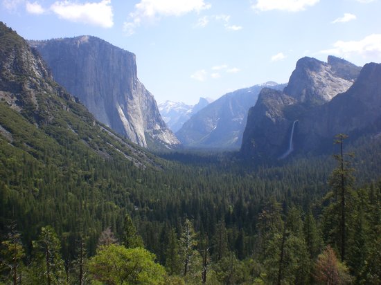
Photo Credit: Yosemite National Park is courtesy of TripAdvisor
Tweet
Posted by Bob Blogger at 7/21/2017 05:44:00 PM 42 comments:
Email ThisBlogThis!Share to XShare to FacebookShare to Pinterest
California, USA Yosemite National Park, California, USA

Wednesday, July 19, 2017

CA-BLM Long Valley Fire 83,733 Acres 57% Crews beginning suppression repair

Long Valley Fire Update
July 19, 2017 0800
Acres Burned: 83,733
Containment: 57%
Fire Started: July 11, 2017
Cause: Under Investigation
Engines: 47
Helicopters: 9
Dozers: 13
Water Tenders: 15
Crews: 25
Total Resources: 896

Doyle, CA, July 19, 2017 – Firefighters worked around the clock securing the containment lines around the fire. Today the focus is on extinguishing hot spots, patrolling the fire perimeter and beginning suppression repair. The spike camp at Sutcliffe will be closed at the end of shift today.Crews 

Suppression repair for the fire will begin on the southeast flank and work northwest working congruently with the Resource Advisors. The focus remains in protecting habitat for the Sage Grouse, Mule Deer, Carson Wandering Skipper butterfly, and the cultural resources in the fire area.

Some unburned islands of vegetation continue to smolder and smoke may be visible from within the burn area. Fire crews are monitoring the fire area.
Please continue to watch for fire vehicles travelling around in the area as crews finish the job of extinguishing the fire and working on suppression repair.
From today on, there will be one update per day.

Contact: Fire Information (831) 265-4193
Information is also available at inciweb.nwcg.gov: please reference Long Valley Fire

Basic Information
Current as of 7/18/2017, 9:23:59 PM
Incident Type Wildfire
Cause Under Investigation
Date of Origin Tuesday July 11th, 2017 approx. 01:30 PM
Location About two miles north of Doyle, California. About 50 miles north of Reno, Nevada.
Incident Commander Bureau of Land Management
Incident Description Wildfire Burning Grass And Sagebrush.

Current Situation
Total Personnel 896
Size 83,733 Acres
Percent of Perimeter Contained 57%
Estimated Containment Date Sunday July 23rd, 2017 approx. 06:00 AM
Fuels Involved
grass and sagebrush
Significant Events
Fire has been fuels and wind driven and very active with short range spotting

Outlook
Planned Actions
Fire fighters are holding, strengthening and constructing direct and indirect lines. Extensive air support utilizing water scooping aircraft, retardant tankers, and rotor wing aircraft occurred.

Projected Incident Activity
Fire activity expected to increase in the Dry Valley area with afternoon winds.
Remarks
Fire progression slowed today and firefighters made excellent progress constructing direct and indirect line with heavy aerial support.

Current Weather
Weather Concerns
An area of low pressure near the Pacific Northwest will bring gusty southwest winds and low humidity with poor overnight recovery tonight and Tuesday leading to a critical fire weather period. The dry air mass will remain in the region through mid week with temperatures in the high 80s. and the Red Flag warning in effect.

UNIT INFORMATION
BLM Shield
Northern California District
Bureau of Land Management
6640 Lockheed Dr
Redding, CA, CA 96002
INCIDENT CONTACTS
Long Valley Fire Information
Phone: 831 265 4193
Hours: M-F 7 am to 10 pm
more contacts »


Tweet
Posted by Bob Blogger at 7/19/2017 01:11:00 PM 6 comments:
Email ThisBlogThis!Share to XShare to FacebookShare to Pinterest
California, USA Doyle, CA 96109, USA

CA-MMU Detwiler Fire - 45,724 acres - 7% Mariposa County With Evacuation Orders

DETWILER FIRE

Detwiler Fire Incident Information:
Last Updated:July 19, 2017 8:00 am
Date/Time Started:July 16, 2017 3:56 pm
Administrative Unit:CAL FIRE Madera-Mariposa-Merced Unit
County:Mariposa County
Location:Detwiler Rd and Hunters Valley Rd, 2 miles east of Lake McClure
Acres Burned - Containment:45,724 acres - 7% contained
Structures Threatened:1,500
Structures Destroyed:8 destroyed and 1 damaged
Evacuations:Evacuation Orders- SOUTH COUNTY are in effect for the following areas: Mount Bullion Ridge Road from HWY 49N to HWY 140 and ALL feeder roads; Old Toll Road between Corbett Creek Road and HWY 49N, including Corbett Creek Road.; Mount Gaines Road to No.9 Road including No.9 Road; HWY 140 from Hornitos Rd. to Hwy 49S and ALL feeder roads both sides. Yaqui Gulch Rd. from HWY 140 to Old HWY ALL feeder roads on both sides. Old HWY from 49S to School House Rd. and ALL feeder roads on both sides. Buckeye Rd. to Benhur Rd. both sides of the road and feeder roads. Benhur from Buckeye to Hwy 49S. Mariposa Town HWY 140 from 49N to East Whitlock Rd. and ALL feeder roads. East Whitlock Rd from HWY 140 to Mosher Rd. and All feeder roads to the West. Hornitos Rd. from HWY 140 to Mount Gaines Rd. and ALL feeder roads. Including the community of Whispering Oaks. West Whitlock from 49N to Mosher Rd. and ALL feeder roads and all areas north of the Merced River
Evacuation Warnings-North County are HWY 49N from Schilling Rd. to HWY 132 including ALL feeder roads. Main Street Coulterville. Dogtown Rd. from Greeley Hill Rd. to Texas Hill Rd. and All of Texas Hill Rd. Schilling Rd from HWY 49N to Texas Hill Rd.
NORTH COUNTY All of the Coulterville and Greeley Hill area SOUTH COUNTY Hwy 49s from Ben Hur Rd to Indian Peak Rd- including all feeder roads Ashworth to Silver Lane including all feeder roads Silver Bar to Ashworth- including all feeder roads Indian Peak to Oak Grove Rd- including all feeder roads Oak Grove Rd from Miwuk Rd to Oak Grove School Rd-including all feeder roads Allred Rd from 49S to Morningstar Lane- including all feeder roads Morningstar Lane to Carlton Rd- including all feeder roads Carlton Rd to Silva Rd- including all feeder roads Silva Rd to Hwy 49 South- including all feeder roads Bear Valley Rd- All homes from Exchequer Rd to Hornitos Rd Hornitos Town Area
Red Cross Evacuation Shelter located at EV Free Church, 50443 School Road, Oakhurst, CA Sierra Vista Presbyterian, 39696 HWY 41, Oakhurst, CA Red Cross Evacuation Shelter located at Cesar Chavez Middle School, 161 Plainsburg Road, Planada CA
Small animals: EV Free Church 50443 School House Road, Oakhurst, CA. And Cesar Chavez Middle School, 161 Plainsburg Road, Planada, CA . (559)-433-9663 Large animals: Mariposa County Animal Control (209)-966-3614
Mariposa County Sheriff's Office Evacation and Road Closure Updates via Nixle
Road Closures:HWY-49 at HWY-132 (Coulterville Rd.) – Restricted access to locals with addresses in La Grange, Coulterville, or Greely Hill only; Bear Valley Rd. at Exchequer Rd.; Hornitos Rd. from Mount Gaines to HWY 140.; HWY-49N from Hwy 140 to HWY 132.; Mt. Gains Rd. at No.9 Rd.; Hwy 49 at Aqua Fria.; Hwy 140 at Aqua Fria. HWY 140 from Triangle Rd. to School House Rd. 49S from HWY 140 to Triangle Rd.
Cooperating Agencies:Mariposa County Sheriff’s Office, CAL OES, Red Cross, PG&E, CHP, Mariposa County Public Works, CALTRANS, Bureau of Land Management, Mariposa County Fairgrounds, Mariposa County Fire, California Dept. of Corrections and Rehabilitation.
Total Fire Personnel:2,208
Total Fire Engines:217
Total Fire Crews:35
Total Airtankers:9
Total Helicopters:11
Total Dozers:35
Total Water Tenders:26
Long/Lat:-120.21321/37.61757
Conditions:Today, firefighters experienced extreme and aggressive fire behavior with active crowning, short- range spotting and uphill runs. The communities of Hunters Valley, Bear Valley, Catheys Valley, Mormon Bar, The Town of Mariposa , Mount Bullion, Yaqui Gulch/Aqua Fria areas and Hornitos continue to be threatened. The fire encroaches on culturally and historically sensitive areas.
Traffic along HWY 149, 49N and 49S will be impacted as a result of road closures. The fire continues to threaten power lines to the south of the incident, which supply power to Yosemite National Park. Firefighters on the ground as well as aircraft are actively working to contain and suppress the fire.
We ask for the public to heed all evacuation orders and warnings. For information about how to prepare for evacuation please visit: www.readyforwildfire.org.
Phone Numbers(844) MMU-FIRE (Fire Information Line )  
Phone Numbers(559) 706-8828 (Media Line )  
Phone Numbers(562) 619-7467 (Media Line )  

Tweet
Posted by Bob Blogger at 7/19/2017 12:48:00 PM 2 comments:
Email ThisBlogThis!Share to XShare to FacebookShare to Pinterest
California, USA Detwiler Rd, Mariposa, CA 95338, USA

Wednesday, July 12, 2017

LODD: CAL FIRE Inmate Firefighter Frank Anaya, 22 Died after suffering a chainsaw injury to the leg

California Firefighter Fatality Notification

The U.S. Fire Administration (USFA) has received notice of the following firefighter fatality: 
California inmate firefighter Frank Anaya has died from injuries he sustained July 5 in a chainsaw accident while battling a wildfire in Lakeside.

Name: Frank Anaya
Rank: Inmate Firefighter
Age: 22
Gender: Male
Status: Wildland Part-Time
Date of Incident: 07/05/2017
Time of Incident: 1330hrs
Date of Death: 07/11/2017
  
Fire Department: CAL FIRE
Address: PO Box 944246, 1416 9th Street, Sacramento, CA 94244-2460
Fire Department Chief: Director Ken Pimlott

Incident Description: Inmate Firefighter Frank Anaya was treated on scene and taken to the hospital in critical condition on July 5, 2017, after suffering a chainsaw injury to the leg while working a fire near Lakeside, California. Fire crews were clearing brush and working with air crews to successfully defend a threatened mobile home park when the injury occurred. Despite all efforts by medical personnel, Inmate Firefighter Anaya passed away on July 11, 2017.

Incident Location: Vicinity of Interstate 8-Business and Los Coches Road.


Photo credit: California Department of Corrections and Rehabilitation
Tribute is being paid to Inmate Firefighter Frank Anaya at http://apps.usfa.fema.gov/firefighter-fatalities/

Tweet
Posted by Bob Blogger at 7/12/2017 10:23:00 AM 4 comments:
Email ThisBlogThis!Share to XShare to FacebookShare to Pinterest
California, USA Hwy 8 Business & Los Coches Rd, Winter Gardens, CA 92021, USA

Tuesday, July 11, 2017

LODD: Fire Engine Operator William "Bill" Jaros, a crewmember on Engine 312 of the Six Rivers National Forest

California Firefighter Fatality Notification

The U.S. Fire Administration (USFA) has received notice of the following firefighter fatality:

Name: William "Bill" Jaros
Rank: Fire Engine Operator
Age: 38
Gender: Male
Status: Wildland Full-Time
Years of Service: 12
Date of Incident: 07/08/2017
Time of Incident: 1315hrs
Date of Death: 07/08/2017

Fire Department: Six Rivers National Forest - Gasquet Ranger District/Smith River National Recreation Area
Address: 1330 Bayshore Way, Eureka, CA 95501
Fire Department Chief: Acting Forest Supervisor Michael Green

Incident Description: Fire Engine Operator William "Bill" Jaros, a crewmember on Engine 312 of the Six Rivers National Forest’s Gasquet Ranger District/Smith River National Recreation Area, was on a conditioning hike with several crewmembers when he became ill and collapsed. Immediate life-saving efforts were initiated by his fellow crewmembers; however, they were unable to revive him. The cause of death is under investigation through the Del Norte County Coroner’s office. Conditioning hikes, such as the one Engine 312 crewmembers were participating, are part of the continuing preparedness routine for firefighters.

Incident Location: Vicinity of 100 Fire House RD, Gasquet, CA 95543

Tribute is being paid to Fire Engine Operator William "Bill" Jaros at http://apps.usfa.fema.gov/firefighter-fatalities/

Tweet
Posted by Bob Blogger at 7/11/2017 07:32:00 PM No comments:
Email ThisBlogThis!Share to XShare to FacebookShare to Pinterest
Newer Posts Older Posts Home
Subscribe to: Posts (Atom)

Twitter Buttons

Follow @CalFireNews Tweet to @CalFireNews Tweet
****REMINDER**** Every fire has the ability to be catastrophic. The wildland fire management environment has profoundly changed. Growing numbers of communities, across the nation, are experiencing longer fire seasons; more frequent, bigger, and more severe, fires are a real threat. Be careful with all campfires and equipment.

"I am a firm believer in the people. If given the truth, they can be depended upon to meet any national crisis. The great point is to bring them the real facts, and beer." --Abraham Lincoln

View blog top tags
---------------------
CLICK HERE TO GO BACK TO TOP OF CALIFORNIA FIRE NEWS HOME PAGE

Subscribe via email to California Fire News - Keep track of Cal Fire News

Enter your email address:

Delivered by FeedBurner

Search This Blog

Current Fire Informational links

  • NICC - Federal Morning Report
  • CalFire - CDF - Active Incident information

CAL FIRE: Incidents

Loading...

Twitter links

Tweet - Follow @CalFireNews

Popular Posts

  • CA-STF-Rim Fire, Tuolumne County 187,466 acres, & is 23% contained, No expected containment date. Wilkins NC IMT1, Lawshe CA IMT1 #CaFire
    Rim Fire , CA-STF-2857  Wildfire  Tuolumne County  FRA 3 miles northeast of Groveland, near Clavey River Canyon ALL FURTHER UPDATES A...
  • (no title)
    Proposed fire district mergers in Calif. county face financial hurdles As smaller agencies seek to join with the Sonoma County Fire Distri...
  • CAL FIRE / USFS Mariposa 2019 Fireline Safety Awareness For Hired Vendors
    2019 Fire line Safety Awareness For Hired Vendors 8hrs required annually for fire-line assignments with CAL FIRE and USFS We have the fo...
  • CAL FIRE Announces Availability of Funding for Projects that Proactively Address Fire Prevention and Forest Health
     CAL FIRE NEWS RELEASE CONTACT: Scott McLean Deputy Chief of Communications (916) 651-FIRE (3473) @CALFIRE_PIO   ...
  • Arson suspect, Missouri man flies to California, sets 13 wildfires, then tries to fly home, cops say
    Freddie Graham, 68, arrested Monday A Missouri man flew to California, spent two days setting wildfires, then tried to fly home, offi...
  • Local News: City of Tracy Firefighters on the ZACA Fireline
    Tracy crews fight southland blaze Source: Tracy Press Bob Brownne Monday, 09 July 2007 Local ...
  • CA-YNP Yosemite National Park Remains Open - Yosemite Valley cannot be accessed from Merced via Highway 140.
    Yosemite National Park Remains Open Yosemite Valley accessible via Highways 140, 120, and 41 Yosemite National Park remains open wit...
  • Camp Fire: CPUC Investigators say PG&E Inspections Flawed Before Paradise Fire
    PG&E Inspections Flawed Before Camp Fire: CPUC Investigators Say Top:  An eroded hook found on tower No. 81 on PG&E's Cari...
  • CA-SNF-#CarstensFire #Wildland Fire CA-SNF-1261, Midpines, Mariposa County 1,708 acres 95% contained. #Cafire
    Carstens Wildland Fire  CA-SNF-1261 ,  Midpines , Mariposa County Evacuation orders lifted for: Jerseydale, Hites Cove, Clarks Valley and...
  • Chariot Fire 7055 acres, 100% [FINAL]
    Chariot Fire CA-MVU-014084 Incident is in Unified Command USFS-CNF and CALFIRE Evacuations: Multiple campgrounds on Mt Laguna including ...

Blog Post Archive Index

  • December (1)
  • December (1)
  • November (2)
  • September (5)
  • August (4)
  • July (1)
  • May (2)
  • February (6)
  • December (9)
  • November (4)
  • October (2)
  • September (4)
  • August (4)
  • June (1)
  • May (2)
  • December (5)
  • November (4)
  • October (1)
  • July (5)
  • June (1)
  • May (2)
  • April (3)
  • February (4)
  • January (2)
  • December (4)
  • November (2)
  • October (6)
  • September (19)
  • August (1)
  • July (7)
  • June (39)
  • May (17)
  • April (23)
  • March (16)
  • October (15)
  • September (6)
  • August (69)
  • July (69)
  • June (65)
  • May (6)
  • April (8)
  • March (11)
  • February (19)
  • January (27)
  • December (5)
  • November (7)
  • October (10)
  • September (32)
  • July (10)
  • June (16)
  • May (50)
  • April (12)
  • March (32)
  • February (24)
  • January (46)
  • December (57)
  • November (50)
  • October (67)
  • September (57)
  • August (101)
  • July (135)
  • June (123)
  • May (155)
  • April (125)
  • March (86)
  • February (61)
  • January (63)
  • December (17)
  • November (83)
  • October (71)
  • September (49)
  • August (66)
  • July (117)
  • June (55)
  • May (29)
  • April (38)
  • March (86)
  • February (63)
  • January (31)
  • December (28)
  • November (37)
  • October (31)
  • September (38)
  • August (33)
  • July (31)
  • June (47)
  • May (36)
  • April (50)
  • March (17)
  • February (18)
  • January (29)
  • December (63)
  • November (74)
  • October (39)
  • September (51)
  • August (47)
  • July (56)
  • June (9)
  • May (6)
  • April (31)
  • March (113)
  • February (88)
  • January (64)
  • December (40)
  • November (16)
  • October (31)
  • September (42)
  • August (65)
  • July (176)
  • June (136)
  • May (125)
  • April (109)
  • March (154)
  • February (136)
  • January (132)
  • December (78)
  • November (149)
  • October (168)
  • September (75)
  • August (99)
  • July (72)
  • June (136)
  • May (124)
  • April (137)
  • March (86)
  • February (77)
  • January (104)
  • December (113)
  • November (93)
  • October (221)
  • September (96)
  • August (265)
  • July (332)
  • June (210)
  • May (136)
  • April (16)
  • March (52)
  • February (12)
  • January (48)
  • December (1)
  • July (1)

InciWeb Incidents for California

Loading...

googlesyndication

Contact Form

Name

Email *

Message *

Followers

CAL FIRE NEWS RSS FEED

Posts
Atom
Posts
All Comments
Atom
All Comments

Facebook Badge

California fire news

Promote Your Page Too

RSS FEED - GET BREAKING CALIFORNIA FIRE NEWS

California Fire News

↑ Grab this Headline Animator

Participate and help others get the real scoop - News, Pictures, Video, Intel

CAL FIRE NEWS
WANTS YOUR
INFO, INTEL, PICTURES,
209 REPORTS, VIDEOS, STORIES,
STATION AND CREW LINKS

send to
CAL FIRE NEWS WEBMASTER
ROCDAD@GMAIL.COM

CFN RSS FEED


calfirenews@gmail.com

California Fire News Content

  • California Fire News Home
  • California News
  • California Wildland Fire Links
  • DONATIONS

CAL FIRE NEWS NEEDS YOU!

WE NEED YOUR INFO, INTEL, PICTURES, 209 REPORTS, GREEN SHEETS, VIDEOS, STORIES,STATION AND CREW LINKS.
send to: calfirenews@gmail.com
CAL FIRE NEWS WEBMASTER

California Fire Department Tweets

Tweets from @CalFireNews/public-safety-fire-20

How fires get their names

Every year in California thousands of wildfires start throughout the state. In most cases, the dispatch center sending the initial resources to a wildland fire will designate a name for the fire, but the first on scene engine or fire official can also name the incident. Fires are usually named for the area in which they start – a geographical location, local landmark, street, lake, mountain, peak, etc. Quickly naming the fire provides responding fire resources with an additional locater, and allows fire officials to track and prioritize incidents by name. For example during the Southern California Fire Siege of 2003, the largest wildland fire in California history, the Cedar Fire in San Diego County, was named after the Cedar Creek Falls area where it started. The destructive Old Fire, which burned during the same time period in San Bernardino County, was named after the road along which it started - Old Waterman Canyon Road.
CAL FIRE is the largest fire department in California and the second largest fire department in the United States. CDF - CAL FIRE Firefighters answer the call more than 300,000 times a year. CAL FIRE Firefighters make up the fire department for 30 of our 58 counties in California and more than 100 local communities. We serve as the incident command during many of California’s most serious disasters. CAL FIRE Firefighters respond to many various types and forms of calls ranging from structural fires, to auto accidents, to earthquakes, to floods, to the spilling of hazardous materials, to every conceivable disaster; CAL FIRE answer's the calls. CAL FIRE is the largest fire department in California and the second largest fire department in the United States . CAL FIRE firefighters protect 33 million acres of State Responsibility Area (SRA). We have over 4,000 members within CAL FIRE and CAL FIRE is associated with the California Professional Firefighters (CPF) and the International Association of Firefighters (IAFF).

Go Back To Top

California Fire News - Focus on Wildland Fires throughout the state. Real fire news when you need it. CAL FIRE news, Fire & EMS Department News, ...
Cal Fire News is for casual public interest, and does *not*constitute an official warning system. Those who choose to read or receive Cal Fire News messages do so with the understanding they are *not* an official instruction, suggestion or permission to take action.


CLICK HERE - BACK TO TOP OF CAL FIRE NEWS HOME PAGE

Heroes

"We find not much in ourselves to admire, we are always privately wanting to be like somebody else. If everybody was satisfied with himself there would be no heroes." -- Mark Twain, Autobiography
CFN - California Fire News 2013. Simple theme. Powered by Blogger.