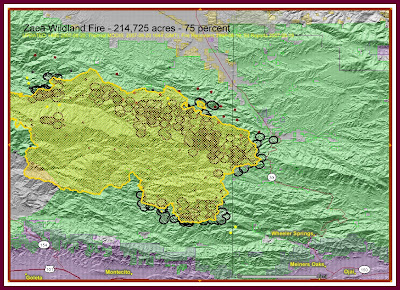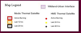


The ZACA Fire is bumping Highway 33 hard according to Geo-Mac Satellite images and mapping and the first hand accounts of Copter chick recounting 100' flame lengths along a fireline Ten to Twenty miles long hitting along highway 33 very hard and the great job by the crews on the ground, so far holding a key contingency line Highway 33 itself .
Geo Mac Modis wildland Wildfire information viewer

UPDATED: HMS 2007-08-20; Thermal MODIS: 2007-08-20 1644 (GMT); Fire Perimeters 2007-08-19; Sit Reports 2007-08-19
UPDATED: HMS 2007-08-20; Thermal MODIS: 2007-08-20 1644 (GMT); Fire Perimeters 2007-08-19; Sit Reports 2007-08-19
No comments:
Post a Comment
CAL FIRE NEWS LOVES COMMENTS...
- Due to rampant abuse, we are no longer posting anonymous comments. Please use your real OpenID, Google, Yahoo, AIM, Twitter, Flickr name.