The ZACA creating its own weather events...
 Weather event showing stream of moisture / winds heading right into ZACA Fire
Credit: NOAA - weather satellite - main site
The ZACA fire has capped out forming Ice caps as high as 25,000 feet repeatably yesterday and formed multiple heads at same time.
 Satellite Animation loops Southern California
Credit: College of Dupage - Visible Satellite Animation
 Satellite Animation loops Southern California
Credit: College of Dupage - Visible Satellite Animation
This event is occurring again this morning click on the above link to watch animation
 Monterey 1km resolution sat image animation
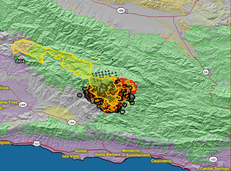 ZACA Fire detected hot spot map
GEOMAC -Thermal Modis 08-05-07
No comments:
Post a Comment
CAL FIRE NEWS LOVES COMMENTS...
- Due to rampant abuse, we are no longer posting anonymous comments. Please use your real OpenID, Google, Yahoo, AIM, Twitter, Flickr name.