Wednesday, April 6, 2016

CA-STF Prescribed fires on the Shasta-Trinity National Forest [MAPS]

Shasta-Trinity National Forest Prescribed Fires


Prescribed fires on the Shasta-Trinity National Forest Beginning on Wednesday, April 6th

Release Date: Apr 6, 2016

REDDING, Calif., April 5, 2016 – Beginning on Wednesday, April 6th, the Shasta-Trinity National Forest will conduct three prescribed fire operations to remove ground fuels on National Forest System lands.

On April 6th, the Trinity River Management Unit will be burning up to 95 acres in the Browns Concentration project area, located northeast of Weaverville off the French Gulch Road. (To see a map, click here.) Ignitions should begin around 11:00 a.m. Wednesday and smoke may be visible in the area for the next few days. For more information on this prescribed burn, contact the Weaverville Ranger Station at (530) 623-2121.

During April 6-7th, the Shasta-McCloud Management Unit will be burning up 200 acres as part of the McIntosh project area, located north of Highway 89 approximately 18 miles east of McCloud.(To see a map, click here.) Smoke will be visible from Highway 89 near Bartle. Smoke impacts to the highway will be minimal. For more information on this prescribed burn, contact the McCloud Ranger Station at (530) 964-2184.

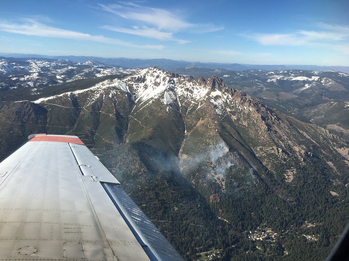
Beginning on Thursday, April 7th, the National Recreation Area Management Unit will burn up to 1200 acres on Green Mountain, which is located north of Redding, near the confluence of the Squaw and Pit Arms of Shasta Lake. (To see a map, click here.)The project is part of the Green Mountain Vegetation Management Project which totals approximately 6,500 acres of prescribed fire. The fire will create smoke that will be visible from many areas on the eastern portion of Shasta Lake, along Interstate 5 near Bridge Bay, and the Silverthorn and Jones Valley areas. Implementation is planned to take approximately 2 days. Smoke may continue to be visible a few days following the prescribed fire. For more information about this prescribed burn, please call the Shasta Lake Ranger Station at (530) 275-1587

All project start dates are dependent upon several factors, such as favorable weather and site conditions. Fire Managers will be evaluating conditions and working with the Air Quality Management District to ensure compliance with air quality regulations and health and safety conditions.

There are several benefits to prescribed fire. Dead vegetation on the ground and ladder fuels that occur between ground fuels and tree crowns will be reduced within prescribed fire areas, making future fire suppression efforts safer while also enhancing habitat for species such as bald eagles, Shasta Salamanders, deer, elk, and turkey. Prescribed fire and other restoration activities on the landscape also improve recreational opportunities for Forest visitors.

For more information or updates about burn progress, please call the Ranger Station phone numbers listed above or visit http://inciweb.nwcg.gov/incident/4124. To learn more about the use of prescribed fire to promote, protect, and conserve Northern California's fire adapted landscapes, please visit http://www.norcalrxfirecouncil.org/.


Contact Information:
Contact: Andrea Crain, Public Affairs Officer, (530) 226-2500
Shasta-Trinity National Forest Headquarters
3644 Avtech Parkway
Redding, CA 96002
(530) 226-2500
711 (TTY) All Offices

AZ-BLM- #TopockFire 2200 acres, 85% Cont. [MAP] #CAFire #AZfire

Pirate Fire, r Arizona California border

New fireline perimeter map:
I saw lots of smoke at dawn. Drove to the marsh, by golden shoresCredit: Daniel Deaton
Officials from Arizona and California say a suspicious, growing wildfire started overnight along the Arizona-California border.

On Wednesday, April 6, 2015, at approximately 5:25 a.m., deputies from the Needles Police/Colorado River Sheriff's Station along with fire personnel from County Fire responded to Park Moabi following the report of a fire. 


The fire started on the Arizona side and winds pushed the fire over to the California side.

As of early Wednesday morning, the "Pirate Incident" fire burning south of Topock and northwest of Lake Havasu City, has burned about 125 acres in both Arizona and California.
Officials said the fire has burned 100 acres in Arizona and 25 Acres on the California side. There is 0% containment.


Mandatory evacuations have been ordered for residents of Park Moabi as well as campers in the area. 


Mandatory evacuation:  residents of Park Moabi and campers - 
 An emergency evacuation center has been established at the Needles Park & Recreation located at 1111 Bailey Avenue. 

Location: Near Needles, San Bernadino County in and around the area of Park Moabi 

Updates:

04/09/2016 0930: Incident transferred command to US Fish and Wildlife Services as a Type 4 Incident
04/08/2016 0930: 2200 acres, 85% Cont. Last night a slop over occurred after gusty winds hit. Dozer and ground crews were able to contain it which was limited to 2-3 acres. Embers and fire brands are still a threat and fire fighters are continuing efforts to reduce danger.
04/07/2016 1930: 2,200ac, winds arrived; established containment lines holding.
04/07/2016 0930: 1500+ acres 40% contained, burnout ops continue.
04/06/2016 1730: 1438 acres burned so far. 68 acres will be backfired tonight. smoke to settle across the Valley and downriver tonight.
04/06/2016 1530: 1,200 acres, prompts evacs in Needles area. #‎SBCoFD‬ unified command with @BLMArizona San Bernardino County Sheriff (‪#‎SBCSD‬) Fish / Wildlife Service & Mohave Valley Fire. #SBCSD #SBCoFD ‪#‎AirRescue‬ 06 and 40King Patrol helicopters still working fire line from the air. Krn

r

04/06/2016 1430: #‎SBCoFD‬ unified command with @BLMArizona San Bernardino County Sheriff (‪#‎SBCSD‬) Fish / Wildlife Service & Mohave Valley Fire. #SBCSD #SBCoFD ‪#‎AirRescue‬ 06 and 40King Patrol helicopters still working fire line from the air. Krn
04/06/2016 1030: ‪#‎SBCoFD‬ ‪#‎AllRisk‬ crew 6-1 working to hold the fire with line construction and natural breaks. ‪#‎SBCSD‬ ‪#‎AirRescue‬ 306 along with Patrol 40King working the fire from the air. Minor damage to some buildings at Pirates Cove Resort, structure protection in place.


#PirateFire: (Update) #SBCoFD #AllRisk crew 6-1 working to hold the fire with line construction and natural breaks. #SBCSD #AirRescue 306 along with Patrol 40King working the fire from the air. Minor damage to some buildings at Pirates Cove Resort, structure protection in place. Krn
Posted by San Bernardino County Fire on Wednesday, April 6, 2016
04/06/2016 0530: San Bernardino County strike teams, air rescue 06, hand crews and a dozer have responded to the incident. According to county fire, approximately 15 acres has burned, winds are 20 mph.

INCIDENT COOPERATORS

Tuesday, April 5, 2016

CA-TNF Sacred Fire: Burning in brush and timber near Sierra City

CA-TNF Sacred Fire - Tahoe National Forest
Forest Service firefighters and cooperators are engaged in a fire burning on private land just north of Sierra City, adjacent to the Tahoe National Forest. Fire size is approximately 30 acres, with a moderate rate of spread. Rotary and fixed wing aircraft are on order.

SACRED FIRE Photo Credit: USFS/Tishner
 Updates:
04/07/2016 1100: CA-TNF Sacred Fire: 23 acres, 100% contained.
04/06/2016 0700: 40 - 60 acres, 40% contained. fire burned onto Tahoe NF. FFs continue building line around the fire. Fire size not expected to increase.
04/05/2016 1700: 30 acres burning in brush and timber. MROS, Fire is located near Sierra City and is currently 5% contained.

More Information: 
Tahoe National Forest
631 Coyote Street
Nevada City, CA 95959
(530) 265-4531(voice)
TTY users dial 711 for telecommunication relay service

Driver loses control of his vehicle, nearly going over the side, gets out and was struck by a passing tour bus.

Driver loses control of his vehicle, nearly going over the side, gets out became disoriented and exited the vehicle and was struck by a passing tour bus.

At 4:30 pm, Malibu-Lost Hills Sheriff's Station responded to a vehicle accident on Malibu Canyon Road, 1/2 mile south of the tunnel. The male adult driver lost control of his vehicle, nearly going over the side. The driver became disoriented and exited the vehicle and was struck by a passing tour bus. Fortunately for the man, he was conscious and breathing on our arrival and was treated by the fast response of our partners at the Los Angeles County Fire Department and California Highway Patrol. He was transported to a local hospital for treatment.

This is another reminder of the need to drive safely through the canyons of our beautiful area and to use extreme caution at the scene of a traffic collision. The accident is being investigated by the CHP.


Source: Lost Hills Sheriff's Station - April 2 at 5:54pm 

EMS Notes: Video - The Only Call That Matters!


Paramedic Lecture: The Only Call That Matters!

In this lecture snippet, Paramedic turned Defense Attorney, David Givot, discusses the importance of staying focused on one call at a time and NOT being tempted to dump, ship, or abandon a patient because a more exciting call has gone out over the radio. 

Paramedic turned defense attorney David Givot, working hard to keep EMS Providers SAFE and to protect the rights of anyone accused of a crime!

North Ops: Northern California Seasonal Outlook And Fuels & Fire Discussion

Northern California Seasonal Outlook And Fire & Fuels Discussion

SEASONAL OUTLOOK For Northern California
Issued April 1, 2016 Valid for MAY - JUL 2016
North Ops Weather, Fuels and Fire Potential Discussion MAY-JUL 2016

Weather and Climate Outlook: The strong El Niño event (Fig 1) that peaked at the beginning of 2016 continues to weaken. For the North Ops region the effects from a strong El Niño on weather patterns - above average precipitation - typically continue into the spring months but with a diminishing trend.
 Temperatures are expected to remain above normal for North Ops (Fig 2), which can lead to higher snow levels than usual during spring storms.
 Precipitation will likely be near to slightly above normal over much of the region at least through May, then closer to normal in June and July (Fig 3).
 Snow pack is slightly below average for April 1 (Fig 4) and it is expected to remain a bit below normal through the Outlook period. Occasional wet weather systems passing through the region
will produce snow at the higher elevations (above 7000 ft), and sometimes at mid elevations (5000-6000 ft) in May, but little to no snow pack is expected to exist below 6000 ft during the Outlook period.

Fire Potential: NORMAL Significant fire activity is expected in all areas through June. Lower elevations east of the Cascade-Sierra crest are expected to see fire potential INCREASE TO ABOVE NORMAL due to the curing of an above normal fine fuel crop. Normal fire activity will continue elsewhere in July.

Normal Significant Fire occurrence is defined as:
May: less than 1 large fire per PSA
June: 1 to 2.5 large fires per PSA
July: 1 to 3 large fires per PSA

May-June: Normal All Areas


Saturday, April 2, 2016

STATEWIDE SNOWPACK SUMMARY - California snow surveys results are in for the month of March.

 MARCH STATEWIDE SNOWPACK SUMMARY
Northern Sierra and Trinity Mountains snow pack reported at 97% of average. 


Provided by the California Cooperative Snow Surveys

STATEWIDE SNOWPACK SUMMARY
Data For: 01-Apr-2016

NORTH
Data For: 01-Apr-2016
Number of Stations Reporting 28
Average snow water equivalent 27.4"
Percent of April 1 Average 95%
Percent of normal for this date 95%

CENTRAL
Data For: 01-Apr-2016
Number of Stations Reporting 39
Average snow water equivalent 25.1"
Percent of April 1 Average 88%
Percent of normal for this date 88%

SOUTH
Data For: 01-Apr-2016
Number of Stations Reporting 27
Average snow water equivalent 19.4"
Percent of April 1 Average 73%
Percent of normal for this date 73%

STATEWIDE SUMMARY
Data For: 01-Apr-2016
Number of Stations Reporting 94
Average snow water equivalent 24.2"
Percent of April 1 Average 86%
Percent of normal for this date 86%

Printable Version of Current Data

Friday, April 1, 2016

FEMA: Pacific Northwest Functional Exercise - Cascadia Rising 2016


Cascadia Rising 2016


The Cascadia Subduction Zone (CSZ) earthquake and tsunami is one of the most complex disaster scenarios that emergency management and public safety officials face in the Pacific Northwest.
Scientific evidence indicates that a magnitude 8.0-9.0 earthquake occurs along the 800-mile long CSZ fault on average once every 200 to 500 years. The last major earthquake and tsunami along the fault occurred over 300 years ago in 1700. Recent subduction zone earthquakes around the world underscore the catastrophic impacts we will face when the next CSZ earthquake and tsunami occurs in our region:
Recent Subduction Zone Earthquakes
  • Indonesia (2004): M9.1 --- 228,000 fatalities
  • Chile (2010): M8.8 --- 500 fatalities
  • Japan (2011): M9.0 --- 18,000 fatalities
Conducting successful life-saving and life-sustaining response operations in the aftermath of a Cascadia Subduction Zone disaster will hinge on the effective coordination and integration of governments at all levels – cities, counties, state agencies, federal officials, the military, tribal nations – as well as non-government organizations and the private sector.  One of the primary goals of Cascadia Rising is to train and test this whole community approach to complex disaster operations together as a joint team.
The culminating event will be a four-day functional exercise to occur June 7-10, 2016. Emergency Operations and Coordination Centers (EOC/ECCs) at all levels of government and the private sector will activate to coordinate simulated field response operations both within their jurisdictions and also with neighboring communities, state EOCs, FEMA, and major military commands.
Above Last Updated: 03/29/2016 - 21:38
Update 04/01/2016  The hashtags we will use for the overall campaign will be #CascadiaEQ to discuss the subduction zone and preparedness, and when it comes to the exercise, we will use #CascadiaRising.

Tuesday, March 29, 2016

U.S. Supreme Court Ruling: Public Employees Right To Free Speech Upheld In Friedrichs v. California Teachers Association

Attorney General Kamala D. Harris Releases Statement on Supreme Court Ruling on Friedrichs v. California Teachers Association

SAN FRANCISCO - Attorney General Kamala D. Harris today issued the following statement in response to the ruling by the U.S. Supreme Court in the case Friedrichs v. California Teachers Association.

"Today's ruling protects the right of public employees working in our schools, universities, hospitals, and police agencies in California and across the nation to negotiate fair wages and benefits, without restricting any individual employee's freedom of speech. While this decision is a victory, we must keep fighting to protect the ability of working families to make a living wage and pursue the American dream."

Sunday, March 27, 2016

Vallejo Mare Island: Two Alarm Warehouse Fire Now Under Control

A two-alarm fire was brought under control Early Easter Sunday morning

VALLEJO (CBS SF) — A two-alarm fire was brought under control Sunday morning at a building on North Mare Island.

Fire officials said at 5:18 a.m. the fires burning at a warehouse located at J street and Azuar Drive were under control and crews remained on scene.

Vallejo Firefighters posted on Twitter at 4:20 a.m. the fire was on the second floor of the structure.

Fire officials said the fire investigator was being called to the scene to investigate.

Twitter Buttons

****REMINDER**** Every fire has the ability to be catastrophic. The wildland fire management environment has profoundly changed. Growing numbers of communities, across the nation, are experiencing longer fire seasons; more frequent, bigger, and more severe, fires are a real threat. Be careful with all campfires and equipment.

"I am a firm believer in the people. If given the truth, they can be depended upon to meet any national crisis. The great point is to bring them the real facts, and beer." --Abraham Lincoln

View blog top tags
---------------------
CLICK HERE TO GO BACK TO TOP OF CALIFORNIA FIRE NEWS HOME PAGE

Subscribe via email to California Fire News - Keep track of Cal Fire News

Enter your email address:

Delivered by FeedBurner